

Cañada del Sereno 21/06/08 GRBK+RodarXcampO - GR168
A cycling route starting in Víznar, Andalusia, Spain.
Overview
About this route
Translated, show original (Spanish)
- -:--
- Duration
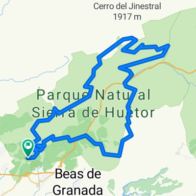
- 33.3 km
- Distance
- 1,090 m
- Ascent
- 890 m
- Descent
- ---
- Avg. speed
- 1,500 m
- Max. altitude

Route quality
Waytypes & surfaces along the route
Waytypes
Quiet road
10.3 km
(31 %)
Path
9 km
(27 %)
Surfaces
Paved
6 km
(18 %)
Unpaved
10 km
(30 %)
Gravel
7.3 km
(22 %)
Asphalt
6 km
(18 %)
Continue with Bikemap
Use, edit, or download this cycling route
You would like to ride Cañada del Sereno 21/06/08 GRBK+RodarXcampO - GR168 or customize it for your own trip? Here is what you can do with this Bikemap route:
Free features
- Save this route as favorite or in collections
- Copy & plan your own version of this route
- Sync your route with Garmin or Wahoo
Premium features
Free trial for 3 days, or one-time payment. More about Bikemap Premium.
- Navigate this route on iOS & Android
- Export a GPX / KML file of this route
- Create your custom printout (try it for free)
- Download this route for offline navigation
Discover more Premium features.
Get Bikemap PremiumFrom our community
Other popular routes starting in Víznar
 Circular Sierra de Huetor Pistas
- Distance
- 60.7 km
- Ascent
- 1,133 m
- Descent
- 1,125 m
- Location
- Víznar, Andalusia, Spain
 FUENTE LA TEJA-HOSPITAL ALFAGUARA-TRINCHERAS
- Distance
- 18.5 km
- Ascent
- 613 m
- Descent
- 613 m
- Location
- Víznar, Andalusia, Spain
 Puerto del Lobo
- Distance
- 27.3 km
- Ascent
- 621 m
- Descent
- 610 m
- Location
- Víznar, Andalusia, Spain
 Cañada del Sereno 21/06/08 GRBK+RodarXcampO - GR168
- Distance
- 33.3 km
- Ascent
- 1,090 m
- Descent
- 890 m
- Location
- Víznar, Andalusia, Spain
 2011.04.17_Fague-Huétor Santillán-Cañada del Sereno-Alfaguara-Fargue
- Distance
- 35.2 km
- Ascent
- 898 m
- Descent
- 896 m
- Location
- Víznar, Andalusia, Spain
 Centro de interpretación Sierra de Huetor - Las mimbres
- Distance
- 15.1 km
- Ascent
- 570 m
- Descent
- 458 m
- Location
- Víznar, Andalusia, Spain
 Circular Sierra de Huetor Pistas
- Distance
- 60.6 km
- Ascent
- 1,104 m
- Descent
- 1,104 m
- Location
- Víznar, Andalusia, Spain
 GR054-Nocturna Sierra Huétor-10/06/06
- Distance
- 26.3 km
- Ascent
- 428 m
- Descent
- 425 m
- Location
- Víznar, Andalusia, Spain
Open it in the app