

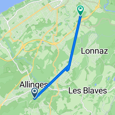
De 2 Route de Noyers, Allinges à 2 Route de Noyers, Allinges
A cycling route starting in Allinges, Auvergne-Rhône-Alpes, France.
Overview
About this route
- 5 h 56 min
- Duration
- 89.8 km
- Distance
- 1,467 m
- Ascent
- 1,465 m
- Descent
- 15.1 km/h
- Avg. speed
- ---
- Max. altitude

Route quality
Waytypes & surfaces along the route
Waytypes
Quiet road
31.4 km
(35 %)
Road
26.9 km
(30 %)
Surfaces
Paved
60.2 km
(67 %)
Unpaved
0.9 km
(1 %)
Asphalt
60.2 km
(67 %)
Gravel
0.9 km
(1 %)
Undefined
28.7 km
(32 %)
Continue with Bikemap
Use, edit, or download this cycling route
You would like to ride De 2 Route de Noyers, Allinges à 2 Route de Noyers, Allinges or customize it for your own trip? Here is what you can do with this Bikemap route:
Free features
- Save this route as favorite or in collections
- Copy & plan your own version of this route
- Split it into stages to create a multi-day tour
- Sync your route with Garmin or Wahoo
Premium features
Free trial for 3 days, or one-time payment. More about Bikemap Premium.
- Navigate this route on iOS & Android
- Export a GPX / KML file of this route
- Create your custom printout (try it for free)
- Download this route for offline navigation
Discover more Premium features.
Get Bikemap PremiumFrom our community
Other popular routes starting in Allinges
 De 2 Route de Noyers, Allinges à 2 Route de Noyers, Allinges
- Distance
- 89.8 km
- Ascent
- 1,467 m
- Descent
- 1,465 m
- Location
- Allinges, Auvergne-Rhône-Alpes, France
 23 avril 2017 Allinges
- Distance
- 18 km
- Ascent
- 237 m
- Descent
- 239 m
- Location
- Allinges, Auvergne-Rhône-Alpes, France
 route geneve
- Distance
- 33.4 km
- Ascent
- 165 m
- Descent
- 338 m
- Location
- Allinges, Auvergne-Rhône-Alpes, France
 9km Allinges
- Distance
- 8.9 km
- Ascent
- 102 m
- Descent
- 101 m
- Location
- Allinges, Auvergne-Rhône-Alpes, France
 Itinéraire vers 119 Avenue de Saint-Disdille, Thonon-les-Bains
- Distance
- 12 km
- Ascent
- 35 m
- Descent
- 357 m
- Location
- Allinges, Auvergne-Rhône-Alpes, France
 sortie vélo du 8 mai 2021
- Distance
- 74.9 km
- Ascent
- 1,226 m
- Descent
- 1,226 m
- Location
- Allinges, Auvergne-Rhône-Alpes, France
 De 2740 Avenue de Lonnaz, Allinges à 274A Avenue de Lonnaz, Allinges
- Distance
- 38.7 km
- Ascent
- 997 m
- Descent
- 997 m
- Location
- Allinges, Auvergne-Rhône-Alpes, France
 De Chemin Rural dit de la Chapelle à Chemin du Crêt de Poche
- Distance
- 5.2 km
- Ascent
- 62 m
- Descent
- 284 m
- Location
- Allinges, Auvergne-Rhône-Alpes, France
Open it in the app