Itinéraire modéré en Monts
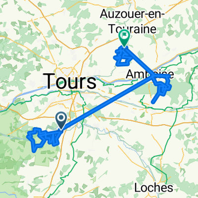
A cycling route starting in Monts, Centre-Val de Loire, France.
Overview
About this route
- 1 h 54 min
- Duration
- 30.4 km
- Distance
- 180 m
- Ascent
- 166 m
- Descent
- 16 km/h
- Avg. speed
- ---
- Max. altitude
Route quality
Waytypes & surfaces along the route
Waytypes
Quiet road
12.7 km
(42 %)
Track
9.1 km
(30 %)
Surfaces
Paved
2.6 km
(9 %)
Unpaved
0.3 km
(<1 %)
Asphalt
2.6 km
(9 %)
Loose gravel
0.3 km
(<1 %)
Undefined
27.5 km
(90 %)
Continue with Bikemap
Use, edit, or download this cycling route
You would like to ride Itinéraire modéré en Monts or customize it for your own trip? Here is what you can do with this Bikemap route:
Free features
- Save this route as favorite or in collections
- Copy & plan your own version of this route
- Sync your route with Garmin or Wahoo
Premium features
Free trial for 3 days, or one-time payment. More about Bikemap Premium.
- Navigate this route on iOS & Android
- Export a GPX / KML file of this route
- Create your custom printout (try it for free)
- Download this route for offline navigation
Discover more Premium features.
Get Bikemap PremiumFrom our community
Other popular routes starting in Monts
- De Rue Jean Colin 31, Monts à Rue Jean Colin 31, Monts
- Distance
- 49.6 km
- Ascent
- 696 m
- Descent
- 698 m
- Location
- Monts, Centre-Val de Loire, France
- la casse pattes
- Distance
- 159.5 km
- Ascent
- 509 m
- Descent
- 529 m
- Location
- Monts, Centre-Val de Loire, France
- De Rue Emile Cohl à Rue Emile Cohl
- Distance
- 14.1 km
- Ascent
- 56 m
- Descent
- 107 m
- Location
- Monts, Centre-Val de Loire, France
- De 18 Rue Georges Bernard, Monts à 9 Allée Alexander Fleming, Montbazon
- Distance
- 9.2 km
- Ascent
- 56 m
- Descent
- 37 m
- Location
- Monts, Centre-Val de Loire, France
- Itinéraire modéré en Monts
- Distance
- 30.4 km
- Ascent
- 180 m
- Descent
- 166 m
- Location
- Monts, Centre-Val de Loire, France
- Recovered Route
- Distance
- 7 km
- Ascent
- 57 m
- Descent
- 38 m
- Location
- Monts, Centre-Val de Loire, France
- Rue du Val de l'Indre, Monts to 12 Rue des Moulins, Montbazon
- Distance
- 7.3 km
- Ascent
- 67 m
- Descent
- 59 m
- Location
- Monts, Centre-Val de Loire, France
- De Rue Jean Colin 33, Monts à Rue Jean Colin 31, Monts
- Distance
- 53.4 km
- Ascent
- 120 m
- Descent
- 222 m
- Location
- Monts, Centre-Val de Loire, France
Open it in the app