

Slovensko1
A cycling route starting in Sobrance, Košický kraj, Slovak Republic.
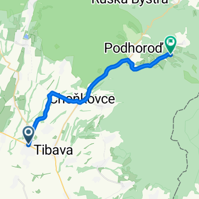
Overview
About this route
- -:--
- Duration
- 366.7 km
- Distance
- 2,063 m
- Ascent
- 1,671 m
- Descent
- ---
- Avg. speed
- ---
- Max. altitude

Route quality
Waytypes & surfaces along the route
Waytypes
Busy road
125.4 km
(34 %)
Road
76.4 km
(21 %)
Surfaces
Paved
183.4 km
(50 %)
Unpaved
31.9 km
(9 %)
Asphalt
170.3 km
(46 %)
Gravel
13.8 km
(4 %)
Route highlights
Points of interest along the route
Point of interest after 94.2 km
fortified wall
Point of interest after 94.6 km
St. Urban’s Tower
Point of interest after 94.7 km
Церква святого Михаїла
Point of interest after 94.8 km
Кафедральний собор св. Альжбети
Point of interest after 94.9 km
Historical Town Hall
Point of interest after 95 km
State Theatre Kosice
Point of interest after 95.2 km
Immaculata
Point of interest after 96.5 km
Mikluš Prison
Point of interest after 96.9 km
Палац Якоба
Point of interest after 102.3 km
Vyhliadkova veza Hradova
Point of interest after 158.7 km
Rimsko-Katolicky Kostol Svateho Jana Krstitela
Point of interest after 158.9 km
Historická Radnica v Spišských Vlachoch
Point of interest after 162.1 km
Holy Spirit Church Žehra
Point of interest after 165.9 km
geoglyph of Celtic horse
Point of interest after 166 km
Spiš Castle
Point of interest after 167.9 km
Church of the Nativity of the Virgin Mary
Point of interest after 168.9 km
Spišská Kapitula and St. Martin's Cathedral
Point of interest after 170.8 km
Siva Brada hillock RC Chapel and springs
Point of interest after 178.1 km
Kaštieľ Spišský Hrhov
Point of interest after 178.8 km
Stone bridge in Spišský Hrhov
Point of interest after 183.6 km
Brama Koszycka
Point of interest after 183.7 km
Stone bridge in Spišský Hrhov
Point of interest after 183.8 km
Thurzo's house
Point of interest after 184.2 km
Baszta Prochownia
Point of interest after 184.6 km
Belfry
Point of interest after 184.7 km
St. Jacob's Church
Point of interest after 184.7 km
Jan Francisci-Rimavsky Gymnasium
Point of interest after 184.7 km
Levoča Old Town Hall
Point of interest after 184.7 km
Mariasila Palace
Point of interest after 184.8 km
Dom Turzonów
Point of interest after 185.1 km
svätého Ladislava
Point of interest after 185.6 km
Master Paul's House
Point of interest after 193.1 km
hrad
Point of interest after 193.1 km
Kastiel a Letohradok Markusovce
Point of interest after 195.8 km
Church of the Virgin Mary's Assumption
Point of interest after 196.6 km
Muzeum Spisa
Point of interest after 214.9 km
Kaštieľ Spišský Štiavnik
Point of interest after 226.8 km
Steinbruchsee
Point of interest after 232.3 km
State Archives
Point of interest after 232.4 km
Spišská Sobota
Point of interest after 235.2 km
Belfry of St. Egidius Church
Point of interest after 251.3 km
Vysoké Tatry Roman Catholic Parish
Point of interest after 274.2 km
Strbske Pleso Lake
Point of interest after 309.2 km
Hrad a Kaštieľ Liptovský Hrádok
Point of interest after 309.3 km
Memorial on the anniversary of the First World War
Continue with Bikemap
Use, edit, or download this cycling route
You would like to ride Slovensko1 or customize it for your own trip? Here is what you can do with this Bikemap route:
Free features
- Save this route as favorite or in collections
- Copy & plan your own version of this route
- Split it into stages to create a multi-day tour
- Sync your route with Garmin or Wahoo
Premium features
Free trial for 3 days, or one-time payment. More about Bikemap Premium.
- Navigate this route on iOS & Android
- Export a GPX / KML file of this route
- Create your custom printout (try it for free)
- Download this route for offline navigation
Discover more Premium features.
Get Bikemap PremiumFrom our community
Other popular routes starting in Sobrance
 Sobrance-Tibava-Podhoroď-Beňatina-Inovce-Ruský Hrabovec-Podhoroď-Choňkovce-Baškovce-Sobrance
- Distance
- 46.4 km
- Ascent
- 542 m
- Descent
- 542 m
- Location
- Sobrance, Košický kraj, Slovak Republic
 Podhoroď-Beňatina-Inovce-Ruský Hrabovec-Podhoroď
- Distance
- 19.7 km
- Ascent
- 407 m
- Descent
- 407 m
- Location
- Sobrance, Košický kraj, Slovak Republic
 Sobrance- Baškovce- Hlivištia- Pilník. Lúka
- Distance
- 15.7 km
- Ascent
- 742 m
- Descent
- 98 m
- Location
- Sobrance, Košický kraj, Slovak Republic
 Sninský kameň, Morské oko
- Distance
- 39.5 km
- Ascent
- 855 m
- Descent
- 856 m
- Location
- Sobrance, Košický kraj, Slovak Republic
 Po lesných cestách I
- Distance
- 69.3 km
- Ascent
- 987 m
- Descent
- 985 m
- Location
- Sobrance, Košický kraj, Slovak Republic
 Slovensko1
- Distance
- 366.7 km
- Ascent
- 2,063 m
- Descent
- 1,671 m
- Location
- Sobrance, Košický kraj, Slovak Republic
 Sobrance- Baškovce- Choňkovce- Beňatina
- Distance
- 18.3 km
- Ascent
- 369 m
- Descent
- 25 m
- Location
- Sobrance, Košický kraj, Slovak Republic
 Sobrance- Choňkovce- Beňatina- Inovce
- Distance
- 20.8 km
- Ascent
- 454 m
- Descent
- 85 m
- Location
- Sobrance, Košický kraj, Slovak Republic
Open it in the app