

VEDERNA
A cycling route starting in Imer, Trentino-Alto Adige, Italy.
Overview
About this route
- -:--
- Duration
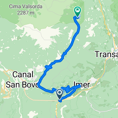
- 31.4 km
- Distance
- 1,179 m
- Ascent
- 1,185 m
- Descent
- ---
- Avg. speed
- ---
- Max. altitude

Route quality
Waytypes & surfaces along the route
Waytypes
Track
23.9 km
(76 %)
Cycleway
2.2 km
(7 %)
Surfaces
Paved
6.9 km
(22 %)
Unpaved
17 km
(54 %)
Gravel
15.1 km
(48 %)
Paved (undefined)
4.4 km
(14 %)
Continue with Bikemap
Use, edit, or download this cycling route
You would like to ride VEDERNA or customize it for your own trip? Here is what you can do with this Bikemap route:
Free features
- Save this route as favorite or in collections
- Copy & plan your own version of this route
- Sync your route with Garmin or Wahoo
Premium features
Free trial for 3 days, or one-time payment. More about Bikemap Premium.
- Navigate this route on iOS & Android
- Export a GPX / KML file of this route
- Create your custom printout (try it for free)
- Download this route for offline navigation
Discover more Premium features.
Get Bikemap PremiumFrom our community
Other popular routes starting in Imer
 Dolomiti 04
- Distance
- 76.9 km
- Ascent
- 2,734 m
- Descent
- 2,041 m
- Location
- Imer, Trentino-Alto Adige, Italy
 giro vederna
- Distance
- 42.2 km
- Ascent
- 1,385 m
- Descent
- 1,383 m
- Location
- Imer, Trentino-Alto Adige, Italy
 VEDERNA
- Distance
- 31.4 km
- Ascent
- 1,179 m
- Descent
- 1,185 m
- Location
- Imer, Trentino-Alto Adige, Italy
 lago Calaita
- Distance
- 15.3 km
- Ascent
- 1,018 m
- Descent
- 58 m
- Location
- Imer, Trentino-Alto Adige, Italy
 Mezzano Sovramonte Mis Cereda
- Distance
- 104.6 km
- Ascent
- 1,947 m
- Descent
- 1,946 m
- Location
- Imer, Trentino-Alto Adige, Italy
 Rifugio Vederna + Malga Agnerola
- Distance
- 37.9 km
- Ascent
- 1,118 m
- Descent
- 1,116 m
- Location
- Imer, Trentino-Alto Adige, Italy
 IMER - IMER
- Distance
- 103.5 km
- Ascent
- 2,659 m
- Descent
- 2,659 m
- Location
- Imer, Trentino-Alto Adige, Italy
 Passo Gobbera
- Distance
- 18.4 km
- Ascent
- 1,086 m
- Descent
- 109 m
- Location
- Imer, Trentino-Alto Adige, Italy
Open it in the app