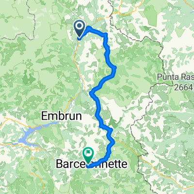
Camping Prelles naar Fort Briancon.
A cycling route starting in Villar-Saint-Pancrace, Provence-Alpes-C么te d'Azur Region, France.
Overview
About this route
Challenging climb with many beautiful views. Surface of cobbles and rocks.
- -:--
- Duration
- 28 km
- Distance
- 856 m
- Ascent
- 854 m
- Descent
- ---
- Avg. speed
- ---
- Max. altitude
Continue with Bikemap
Use, edit, or download this cycling route
You would like to ride Camping Prelles naar Fort Briancon. or customize it for your own trip? Here is what you can do with this Bikemap route:
Free features
- Save this route as favorite or in collections
- Copy & plan your own version of this route
- Sync your route with Garmin or Wahoo
Premium features
Free trial for 3 days, or one-time payment. More about Bikemap Premium.
- Navigate this route on iOS & Android
- Export a GPX / KML file of this route
- Create your custom printout (try it for free)
- Download this route for offline navigation
Discover more Premium features.
Get Bikemap PremiumFrom our community
Other popular routes starting in Villar-Saint-Pancrace
- alpen2015-tag2+3
- Distance
- 190.9 km
- Ascent
- 3,092 m
- Descent
- 4,533 m
- Location
- Villar-Saint-Pancrace, Provence-Alpes-C么te d'Azur Region, France
- Col de L'Izoard - Briancon - Guillestre
- Distance
- 60.3 km
- Ascent
- 405 m
- Descent
- 1,872 m
- Location
- Villar-Saint-Pancrace, Provence-Alpes-C么te d'Azur Region, France
- 0816-Napo-Pontechi
- Distance
- 54.8 km
- Ascent
- 1,949 m
- Descent
- 2,523 m
- Location
- Villar-Saint-Pancrace, Provence-Alpes-C么te d'Azur Region, France
- Brian莽on - Lago di Malciaussia
- Distance
- 194.1 km
- Ascent
- 4,100 m
- Descent
- 3,531 m
- Location
- Villar-Saint-Pancrace, Provence-Alpes-C么te d'Azur Region, France
- Achter de camping Prelles.
- Distance
- 16.6 km
- Ascent
- 510 m
- Descent
- 509 m
- Location
- Villar-Saint-Pancrace, Provence-Alpes-C么te d'Azur Region, France
- Gersau - Nizza: 6. Etappe
- Distance
- 80.5 km
- Ascent
- 1,675 m
- Descent
- 2,229 m
- Location
- Villar-Saint-Pancrace, Provence-Alpes-C么te d'Azur Region, France
- alpen2015-tag2
- Distance
- 44.2 km
- Ascent
- 1,232 m
- Descent
- 1,701 m
- Location
- Villar-Saint-Pancrace, Provence-Alpes-C么te d'Azur Region, France
- Col de Izoard vedlajsi
- Distance
- 93 km
- Ascent
- 1,764 m
- Descent
- 1,766 m
- Location
- Villar-Saint-Pancrace, Provence-Alpes-C么te d'Azur Region, France
Open it in the app