

tes en subida al 10 %
A cycling route starting in Otero de Herreros, Castille and León, Spain.
Overview
About this route
- -:--
- Duration
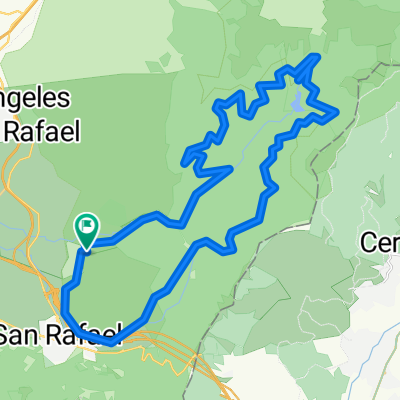
- 5.2 km
- Distance
- 48 m
- Ascent
- 309 m
- Descent
- ---
- Avg. speed
- ---
- Max. altitude
Route quality
Waytypes & surfaces along the route
Waytypes
Quiet road
5.2 km
(100 %)
Continue with Bikemap
Use, edit, or download this cycling route
You would like to ride tes en subida al 10 % or customize it for your own trip? Here is what you can do with this Bikemap route:
Free features
- Save this route as favorite or in collections
- Copy & plan your own version of this route
- Sync your route with Garmin or Wahoo
Premium features
Free trial for 3 days, or one-time payment. More about Bikemap Premium.
- Navigate this route on iOS & Android
- Export a GPX / KML file of this route
- Create your custom printout (try it for free)
- Download this route for offline navigation
Discover more Premium features.
Get Bikemap PremiumFrom our community
Other popular routes starting in Otero de Herreros
 Intento senda del ingeniero
- Distance
- 65 km
- Ascent
- 769 m
- Descent
- 365 m
- Location
- Otero de Herreros, Castille and León, Spain
 Vuelta al valle del río Moros
- Distance
- 32 km
- Ascent
- 534 m
- Descent
- 543 m
- Location
- Otero de Herreros, Castille and León, Spain
 De Calle Castejón 38, Otero de Herreros a Calle San Rafael 24, Otero de Herreros
- Distance
- 2.2 km
- Ascent
- 11 m
- Descent
- 29 m
- Location
- Otero de Herreros, Castille and León, Spain
 El Espinar- Garganta del Rio Moros
- Distance
- 27.9 km
- Ascent
- 423 m
- Descent
- 422 m
- Location
- Otero de Herreros, Castille and León, Spain
 Estacion-Losa-Risca-Navas-Caloco45K760m
- Distance
- 45.5 km
- Ascent
- 624 m
- Descent
- 623 m
- Location
- Otero de Herreros, Castille and León, Spain
 Estacion-Pasapan47K920mV1A
- Distance
- 47.1 km
- Ascent
- 813 m
- Descent
- 813 m
- Location
- Otero de Herreros, Castille and León, Spain
 Garganta rio moros
- Distance
- 27 km
- Ascent
- 571 m
- Descent
- 570 m
- Location
- Otero de Herreros, Castille and León, Spain
 Rio Moros alargada 190525
- Distance
- 39.2 km
- Ascent
- 555 m
- Descent
- 555 m
- Location
- Otero de Herreros, Castille and León, Spain
Open it in the app