


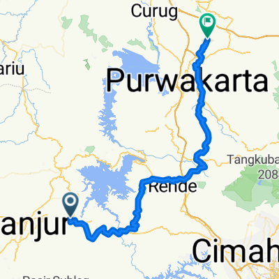
Jalan Nasional III, Kecamatan Sukaluyu to Jalan Nasional III, Kecamatan Sukaluyu
A cycling route starting in Ciranjang-hilir, West Java, Indonesia.
Overview
About this route
0
- 4:25 h
- Duration
- 34.9 km
- Distance
- 295 m
- Ascent
- 308 m
- Descent
- 7.9 km/h
- Avg. speed
- ---
- Max. altitude
Deden Hendrayani
created this 6 years ago
Route photos


Continue with Bikemap
Use, edit, or download this cycling route
You would like to ride Jalan Nasional III, Kecamatan Sukaluyu to Jalan Nasional III, Kecamatan Sukaluyu or customize it for your own trip? Here is what you can do with this Bikemap route:
Free features
- Save this route as favorite or in collections
- Copy & plan your own version of this route
- Sync your route with Garmin or Wahoo
Premium features
Free trial for 3 days, or one-time payment. More about Bikemap Premium.
- Navigate this route on iOS & Android
- Export a GPX / KML file of this route
- Create your custom printout (try it for free)
- Download this route for offline navigation
Discover more Premium features.
Get Bikemap PremiumFrom our community
Other popular routes starting in Ciranjang-hilir
 Jalan Pasir Randu No.400, Kecamatan Ciranjang to Jalan Pasir Randu No.400, Kecamatan Ciranjang1
- 12.3 km
- 180 m
- 176 m
- Ciranjang-hilir, West Java, Indonesia


 Jalan Nasional III, Kecamatan Sukaluyu to Jalan Nasional III, Kecamatan Sukaluyu0
- 21.3 km
- 87 m
- 87 m
- Ciranjang-hilir, West Java, Indonesia


Open it in the app