

4.Etappe: Massad - Audedressin
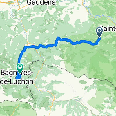
A cycling route starting in Saint-Girons, Occitanie, France.
Overview
About this route
Massad (625m)
Col de Agnes (1580m)
Aulus les-Bains (724m)
Col de Latrape (1120m)
Guzet-Neige (1620m)
Seix (498m)
Col de la Core (1395m)
Castillon-en-Couserans (529m)
Audressein (510m)
- -:--
- Duration
- 98.1 km
- Distance
- 2,740 m
- Ascent
- 2,887 m
- Descent
- ---
- Avg. speed
- ---
- Max. altitude
Route highlights
Points of interest along the route
Point of interest after 17 km
Col de Agnes (1580m)
Point of interest after 32 km
Col de Latrape (1120m)
Point of interest after 41.6 km
Guzet-Neige (1620m)
Point of interest after 80.7 km
Col de la Core (1395m)
Continue with Bikemap
Use, edit, or download this cycling route
You would like to ride 4.Etappe: Massad - Audedressin or customize it for your own trip? Here is what you can do with this Bikemap route:
Free features
- Save this route as favorite or in collections
- Copy & plan your own version of this route
- Split it into stages to create a multi-day tour
- Sync your route with Garmin or Wahoo
Premium features
Free trial for 3 days, or one-time payment. More about Bikemap Premium.
- Navigate this route on iOS & Android
- Export a GPX / KML file of this route
- Create your custom printout (try it for free)
- Download this route for offline navigation
Discover more Premium features.
Get Bikemap PremiumFrom our community
Other popular routes starting in Saint-Girons
 D10 Saint Girons-Ax les Termes
- Distance
- 101.6 km
- Ascent
- 1,927 m
- Descent
- 1,927 m
- Location
- Saint-Girons, Occitanie, France
 audressein- col de portech-col d'agnes-col de lers-les cabannes
- Distance
- 102.2 km
- Ascent
- 1,736 m
- Descent
- 1,727 m
- Location
- Saint-Girons, Occitanie, France
 Transpi-carretera-gr10-parte2
- Distance
- 352.5 km
- Ascent
- 5,257 m
- Descent
- 5,748 m
- Location
- Saint-Girons, Occitanie, France
 Stage 6 - Cent Cols
- Distance
- 77.4 km
- Ascent
- 1,656 m
- Descent
- 1,724 m
- Location
- Saint-Girons, Occitanie, France
 Itinéraire vers Ouerdes, Eycheil
- Distance
- 29.3 km
- Ascent
- 3,110 m
- Descent
- 3,199 m
- Location
- Saint-Girons, Occitanie, France
 MTB Pyrenäenrundfahrt 2 Moulis-Bagneres de Luchons
- Distance
- 75.4 km
- Ascent
- 2,268 m
- Descent
- 2,176 m
- Location
- Saint-Girons, Occitanie, France
 audressein-st. girons-massat-col de lers-les cabannes
- Distance
- 91.4 km
- Ascent
- 1,170 m
- Descent
- 1,169 m
- Location
- Saint-Girons, Occitanie, France
 E_Pyr_Massat-35
- Distance
- 34.9 km
- Ascent
- 1,125 m
- Descent
- 1,128 m
- Location
- Saint-Girons, Occitanie, France
Open it in the app