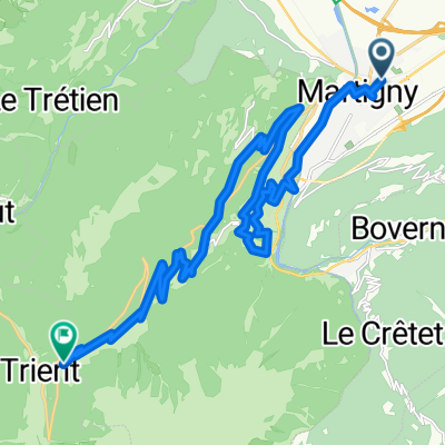
Planachaux DEFINITIEF
A cycling route starting in Martigny-Ville, Valais, Switzerland.
Overview
About this route
- -:--
- Duration
- 80.2 km
- Distance
- 1,281 m
- Ascent
- 1,283 m
- Descent
- ---
- Avg. speed
- ---
- Max. altitude
Route quality
Waytypes & surfaces along the route
Waytypes
Quiet road
34.5 km
(43 %)
Access road
8 km
(10 %)
Surfaces
Paved
50.5 km
(63 %)
Asphalt
50.5 km
(63 %)
Undefined
29.7 km
(37 %)
Route highlights
Points of interest along the route
Point of interest after 31 km
Champoussin
Point of interest after 40.1 km
Planachaux
Point of interest after 40.1 km
Les Crosets
Point of interest after 52.9 km
Pas de Morgins (French / Swiss border)
Continue with Bikemap
Use, edit, or download this cycling route
You would like to ride Planachaux DEFINITIEF or customize it for your own trip? Here is what you can do with this Bikemap route:
Free features
- Save this route as favorite or in collections
- Copy & plan your own version of this route
- Split it into stages to create a multi-day tour
- Sync your route with Garmin or Wahoo
Premium features
Free trial for 3 days, or one-time payment. More about Bikemap Premium.
- Navigate this route on iOS & Android
- Export a GPX / KML file of this route
- Create your custom printout (try it for free)
- Download this route for offline navigation
Discover more Premium features.
Get Bikemap PremiumFrom our community
Other popular routes starting in Martigny-Ville
- Etape 4 : Martigny - Station de Verbier (Tour de Suisse, Aramis) 40 km
- Distance
- 40.5 km
- Ascent
- 2,293 m
- Descent
- 653 m
- Location
- Martigny-Ville, Valais, Switzerland
- Jumelage 2015, étape 1
- Distance
- 127.6 km
- Ascent
- 1,987 m
- Descent
- 2,149 m
- Location
- Martigny-Ville, Valais, Switzerland
- VR04 Martigny-St Gingolph.kml - VR04 Martigny-St Gingolph.kml_VR04 Martigny-St Gingolph
- Distance
- 60.4 km
- Ascent
- 408 m
- Descent
- 484 m
- Location
- Martigny-Ville, Valais, Switzerland
- Colonel
- Distance
- 214.5 km
- Ascent
- 3,599 m
- Descent
- 3,601 m
- Location
- Martigny-Ville, Valais, Switzerland
- Martigny-Thollon
- Distance
- 69.9 km
- Ascent
- 1,891 m
- Descent
- 1,444 m
- Location
- Martigny-Ville, Valais, Switzerland
- 1. Etappe: Martigny - Rund um den Mont Blanc nach Les Saisies
- Distance
- 100 km
- Ascent
- 2,702 m
- Descent
- 1,515 m
- Location
- Martigny-Ville, Valais, Switzerland
- Belle montée, peu de voitures
- Distance
- 20.4 km
- Ascent
- 975 m
- Descent
- 38 m
- Location
- Martigny-Ville, Valais, Switzerland
- Forclaz backroad - Champex Lac - Col des Planches / Col du Lein
- Distance
- 102 km
- Ascent
- 3,119 m
- Descent
- 3,118 m
- Location
- Martigny-Ville, Valais, Switzerland
Open it in the app