
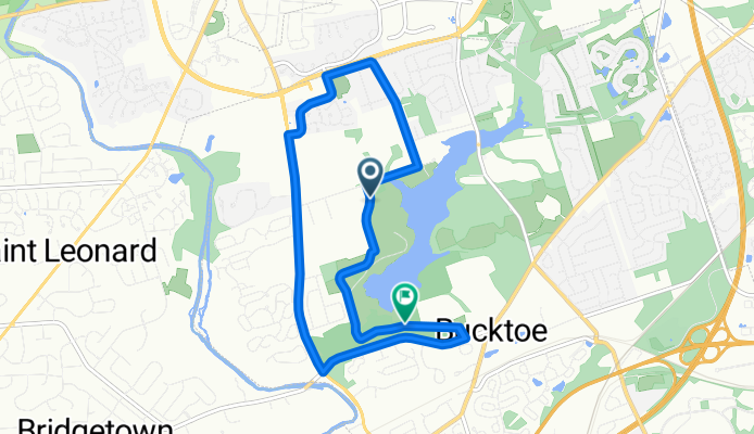
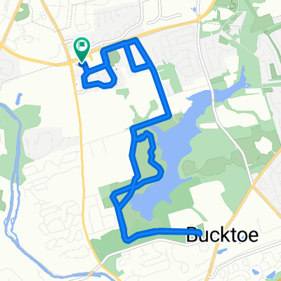
Tri bike route
A cycling route starting in Newtown, Pennsylvania, United States.
Overview
About this route
Start at dog park in core creek Bike to end right onto Bridgetown Right onto langhore yardley Right onto Summit Right onto double woods right onto Fulling mill Right onto Tollgate Right back into Core creek Bike to end turn around and finish at large parking lot Start run
- -:--
- Duration
- 14.1 km
- Distance
- 108 m
- Ascent
- 111 m
- Descent
- ---
- Avg. speed
- ---
- Max. altitude

Route quality
Waytypes & surfaces along the route
Waytypes
Quiet road
9 km
(64 %)
Road
2.5 km
(18 %)
Undefined
2.5 km
(18 %)
Surfaces
Paved
11 km
(78 %)
Asphalt
11 km
(78 %)
Undefined
3.1 km
(22 %)
Continue with Bikemap
Use, edit, or download this cycling route
You would like to ride Tri bike route or customize it for your own trip? Here is what you can do with this Bikemap route:
Free features
- Save this route as favorite or in collections
- Copy & plan your own version of this route
- Sync your route with Garmin or Wahoo
Premium features
Free trial for 3 days, or one-time payment. More about Bikemap Premium.
- Navigate this route on iOS & Android
- Export a GPX / KML file of this route
- Create your custom printout (try it for free)
- Download this route for offline navigation
Discover more Premium features.
Get Bikemap PremiumFrom our community
Other popular routes starting in Newtown
 9 Chestnut Dr, Newtown to 9 Chestnut Dr, Newtown
- Distance
- 11.4 km
- Ascent
- 98 m
- Descent
- 97 m
- Location
- Newtown, Pennsylvania, United States
 Tri bike route
- Distance
- 14.1 km
- Ascent
- 108 m
- Descent
- 111 m
- Location
- Newtown, Pennsylvania, United States
 51 Chestnut Dr, Newtown to 11801 Long Beach Blvd, Long Beach Township
- Distance
- 206.8 km
- Ascent
- 846 m
- Descent
- 890 m
- Location
- Newtown, Pennsylvania, United States
 Pavilion, Newtown to Pavilion, Newtown
- Distance
- 6.1 km
- Ascent
- 96 m
- Descent
- 86 m
- Location
- Newtown, Pennsylvania, United States
 Main Park Road, Newtown to Main Park Road, Newtown
- Distance
- 13.7 km
- Ascent
- 190 m
- Descent
- 166 m
- Location
- Newtown, Pennsylvania, United States
 Lengthy bike tour through Middletown
- Distance
- 57.7 km
- Ascent
- 351 m
- Descent
- 348 m
- Location
- Newtown, Pennsylvania, United States
 Slow ride in Langhorne
- Distance
- 14.5 km
- Ascent
- 120 m
- Descent
- 122 m
- Location
- Newtown, Pennsylvania, United States
 Route from 575 Grant St, Newtown
- Distance
- 18.3 km
- Ascent
- 254 m
- Descent
- 154 m
- Location
- Newtown, Pennsylvania, United States
Open it in the app