

Bärnkopf Dürnbergstrecke
A cycling route starting in Bärnkopf, Lower Austria, Austria.
Overview
About this route
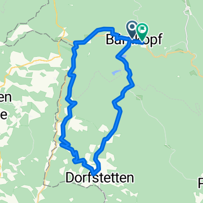
Start bei der Einkehrstube Wackelstein in Bärnkopf, gegenüber Friedhof links abbiegen, ca. 4 km auf ehemaliger Bahntrasse<br />bis Annabild, ab hier steile Asphaltabfahrt ca. 3 km Autoverkehr, in Saggraben entlang dem Prinzbach, Forstschranken.<br />Ab hier stetiger Anstieg vorbei am Dürnbergteich bis Bärnkopf.
- -:--
- Duration
- 18.8 km
- Distance
- 294 m
- Ascent
- 294 m
- Descent
- ---
- Avg. speed
- ---
- Max. altitude
Route quality
Waytypes & surfaces along the route
Waytypes
Track
8.2 km
(44 %)
Quiet road
5.7 km
(30 %)
Surfaces
Paved
2.7 km
(15 %)
Unpaved
13 km
(69 %)
Gravel
8 km
(42 %)
Unpaved (undefined)
4 km
(21 %)
Continue with Bikemap
Use, edit, or download this cycling route
You would like to ride Bärnkopf Dürnbergstrecke or customize it for your own trip? Here is what you can do with this Bikemap route:
Free features
- Save this route as favorite or in collections
- Copy & plan your own version of this route
- Sync your route with Garmin or Wahoo
Premium features
Free trial for 3 days, or one-time payment. More about Bikemap Premium.
- Navigate this route on iOS & Android
- Export a GPX / KML file of this route
- Create your custom printout (try it for free)
- Download this route for offline navigation
Discover more Premium features.
Get Bikemap PremiumFrom our community
Other popular routes starting in Bärnkopf
 Kombitour 6 & 19 Variante B
- Distance
- 51.5 km
- Ascent
- 1,131 m
- Descent
- 1,132 m
- Location
- Bärnkopf, Lower Austria, Austria
 Granittrail nr.3
- Distance
- 46.9 km
- Ascent
- 586 m
- Descent
- 1,324 m
- Location
- Bärnkopf, Lower Austria, Austria
 Bärnkopf - Ysperklammstrecke
- Distance
- 30.6 km
- Ascent
- 680 m
- Descent
- 680 m
- Location
- Bärnkopf, Lower Austria, Austria
 Dürnberg-Strecke MTB
- Distance
- 19 km
- Ascent
- 343 m
- Descent
- 341 m
- Location
- Bärnkopf, Lower Austria, Austria
 4W7-1 Weinsberger Wald - Ysperklamm
- Distance
- 20.3 km
- Ascent
- 667 m
- Descent
- 668 m
- Location
- Bärnkopf, Lower Austria, Austria
 Bärnkopf: Granittrail 3. Teiletappe
- Distance
- 45.4 km
- Ascent
- 638 m
- Descent
- 1,375 m
- Location
- Bärnkopf, Lower Austria, Austria
 Route in Bärnkopf
- Distance
- 24.5 km
- Ascent
- 919 m
- Descent
- 893 m
- Location
- Bärnkopf, Lower Austria, Austria
 Bärnkopf Dürnbergstrecke
- Distance
- 18.8 km
- Ascent
- 294 m
- Descent
- 294 m
- Location
- Bärnkopf, Lower Austria, Austria
Open it in the app