

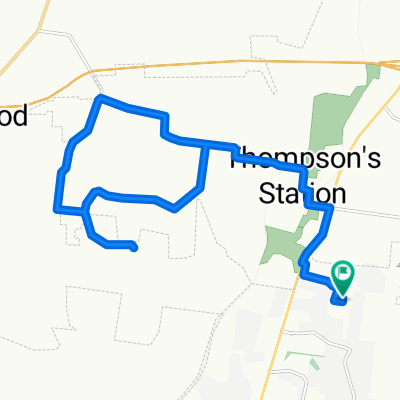
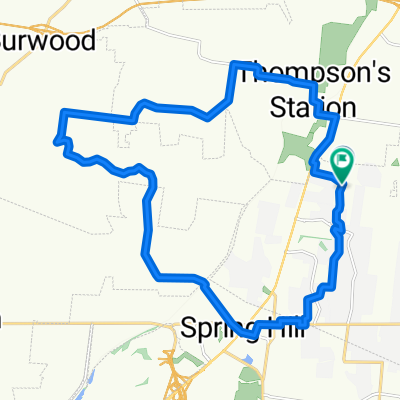
16 Mile Route to Spring Hill
A cycling route starting in Thompson's Station, Tennessee, United States.
Overview
About this route
- -:--
- Duration
- 26 km
- Distance
- 218 m
- Ascent
- 220 m
- Descent
- ---
- Avg. speed
- ---
- Max. altitude

Route quality
Waytypes & surfaces along the route
Waytypes
Quiet road
19.2 km
(74 %)
Road
4.7 km
(18 %)
Surfaces
Paved
11.9 km
(46 %)
Asphalt
11.9 km
(46 %)
Undefined
14 km
(54 %)
Continue with Bikemap
Use, edit, or download this cycling route
You would like to ride 16 Mile Route to Spring Hill or customize it for your own trip? Here is what you can do with this Bikemap route:
Free features
- Save this route as favorite or in collections
- Copy & plan your own version of this route
- Sync your route with Garmin or Wahoo
Premium features
Free trial for 3 days, or one-time payment. More about Bikemap Premium.
- Navigate this route on iOS & Android
- Export a GPX / KML file of this route
- Create your custom printout (try it for free)
- Download this route for offline navigation
Discover more Premium features.
Get Bikemap PremiumFrom our community
Other popular routes starting in Thompson's Station
 Short Thompsons Station
- Distance
- 24.3 km
- Ascent
- 167 m
- Descent
- 165 m
- Location
- Thompson's Station, Tennessee, United States
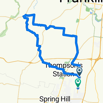 Breakfast Route
- Distance
- 47.1 km
- Ascent
- 225 m
- Descent
- 250 m
- Location
- Thompson's Station, Tennessee, United States
 5412 Pinewood Rd, Franklin to 5412 Pinewood Rd, Franklin
- Distance
- 35.7 km
- Ascent
- 702 m
- Descent
- 697 m
- Location
- Thompson's Station, Tennessee, United States
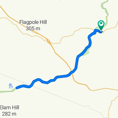
 Thompson's Station Road West 1798 to Carters Creek Pike 5273, Thompson's Station
- Distance
- 3.2 km
- Ascent
- 7 m
- Descent
- 0 m
- Location
- Thompson's Station, Tennessee, United States
 Tania's house route
- Distance
- 41.4 km
- Ascent
- 459 m
- Descent
- 448 m
- Location
- Thompson's Station, Tennessee, United States
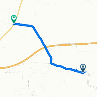
 4053 Lioncrest Ln, Thompson's Station to 4049 Lioncrest Ln, Thompson's Station
- Distance
- 10 km
- Ascent
- 124 m
- Descent
- 126 m
- Location
- Thompson's Station, Tennessee, United States
 16 Mile Route to Spring Hill
- Distance
- 26 km
- Ascent
- 218 m
- Descent
- 220 m
- Location
- Thompson's Station, Tennessee, United States
 Tour of Thompsons Station
- Distance
- 40 km
- Ascent
- 500 m
- Descent
- 500 m
- Location
- Thompson's Station, Tennessee, United States
Open it in the app