

2020 Österreich Rad Rundfahrt - Corona Crisis
ORR_05_Weissenbach-Traismauer
A cycling route starting in Weissenbach an der Triesting, Lower Austria, Austria.
Overview
About this route
Gefahren am 23 August 2020
Radwege: Triesting Radweg (42); Golsen Radweg (42) (höchster Punkt 679 m) ; Traisen Radweg (4)
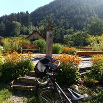
Perfekte Runde, nach einen Anstieg von etwa 300 Höhenmeter innerhalb von ca. 20 km, in wunderschöner Natur ohne Verkehrsbelastung, folgt eine Abfahrt von ca 65 km bis Traismauer. Alle drei Radwege sind von sehr guter Qualität, teilweise optimal. Empfehlenswert!!!
- -:--
- Duration
- 85 km
- Distance
- 318 m
- Ascent
- 505 m
- Descent
- ---
- Avg. speed
- ---
- Max. altitude

Part of
Route quality
Waytypes & surfaces along the route
Waytypes
Quiet road
32.3 km
(38 %)
Track
32.3 km
(38 %)
Surfaces
Paved
56.1 km
(66 %)
Asphalt
50.2 km
(59 %)
Paved (undefined)
6 km
(7 %)
Undefined
28.9 km
(34 %)
Continue with Bikemap
Use, edit, or download this cycling route
You would like to ride ORR_05_Weissenbach-Traismauer or customize it for your own trip? Here is what you can do with this Bikemap route:
Free features
- Save this route as favorite or in collections
- Copy & plan your own version of this route
- Split it into stages to create a multi-day tour
- Sync your route with Garmin or Wahoo
Premium features
Free trial for 3 days, or one-time payment. More about Bikemap Premium.
- Navigate this route on iOS & Android
- Export a GPX / KML file of this route
- Create your custom printout (try it for free)
- Download this route for offline navigation
Discover more Premium features.
Get Bikemap PremiumFrom our community
Other popular routes starting in Weissenbach an der Triesting
 Weissenb - Pottenst - Furth - Kieneck - Hocheck - Weissenb CLONED FROM ROUTE 386937
- Distance
- 48.2 km
- Ascent
- 1,750 m
- Descent
- 1,755 m
- Location
- Weissenbach an der Triesting, Lower Austria, Austria
 MTB_Weissenbach Traiskirchen hügelig
- Distance
- 28.1 km
- Ascent
- 181 m
- Descent
- 327 m
- Location
- Weissenbach an der Triesting, Lower Austria, Austria
 2013-08-31 Weissenbach
- Distance
- 77.7 km
- Ascent
- 648 m
- Descent
- 653 m
- Location
- Weissenbach an der Triesting, Lower Austria, Austria
 Hauptstraße, Weissenbach an der Triesting nach Kremser Gasse, Sankt Pölten
- Distance
- 68.3 km
- Ascent
- 511 m
- Descent
- 616 m
- Location
- Weissenbach an der Triesting, Lower Austria, Austria
 Lange Ausfahrt durch Neuhaus
- Distance
- 38.3 km
- Ascent
- 325 m
- Descent
- 326 m
- Location
- Weissenbach an der Triesting, Lower Austria, Austria
 Hafnerberg - Strecke _ neu_end
- Distance
- 21.7 km
- Ascent
- 368 m
- Descent
- 369 m
- Location
- Weissenbach an der Triesting, Lower Austria, Austria
 ORR_05_Weissenbach-Traismauer
- Distance
- 85 km
- Ascent
- 318 m
- Descent
- 505 m
- Location
- Weissenbach an der Triesting, Lower Austria, Austria
 Weissenbach_Boeheimkirchen
- Distance
- 67.4 km
- Ascent
- 270 m
- Descent
- 374 m
- Location
- Weissenbach an der Triesting, Lower Austria, Austria
Open it in the app