

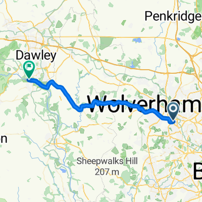
Severn Valley day ride
A cycling route starting in Wolverhampton, England, United Kingdom.
Overview
About this route
A testing ride with hilly terrain in the middle section including two ascents in excess of 1 in 7. Take note that there are not many food stops between Broseley and Arley, although the Fighting Cocks at Stottesdon can be recommended. The Church of St Mary here is also worth a visit.
- -:--
- Duration
- 110.1 km
- Distance
- 606 m
- Ascent
- 606 m
- Descent
- ---
- Avg. speed
- ---
- Max. altitude
Continue with Bikemap
Use, edit, or download this cycling route
You would like to ride Severn Valley day ride or customize it for your own trip? Here is what you can do with this Bikemap route:
Free features
- Save this route as favorite or in collections
- Copy & plan your own version of this route
- Split it into stages to create a multi-day tour
- Sync your route with Garmin or Wahoo
Premium features
Free trial for 3 days, or one-time payment. More about Bikemap Premium.
- Navigate this route on iOS & Android
- Export a GPX / KML file of this route
- Create your custom printout (try it for free)
- Download this route for offline navigation
Discover more Premium features.
Get Bikemap PremiumFrom our community
Other popular routes starting in Wolverhampton
 NCR81 and South Staffs Railway Walk Route
- Distance
- 21.9 km
- Ascent
- 61 m
- Descent
- 58 m
- Location
- Wolverhampton, England, United Kingdom
 Wolverhampton to Bristol
- Distance
- 347.6 km
- Ascent
- 1,426 m
- Descent
- 1,558 m
- Location
- Wolverhampton, England, United Kingdom
 My first route
- Distance
- 34.6 km
- Ascent
- 0 m
- Descent
- 0 m
- Location
- Wolverhampton, England, United Kingdom
 Severn Valley day ride
- Distance
- 110.1 km
- Ascent
- 606 m
- Descent
- 606 m
- Location
- Wolverhampton, England, United Kingdom
 My 3rd route
- Distance
- 47 km
- Ascent
- 0 m
- Descent
- 0 m
- Location
- Wolverhampton, England, United Kingdom
 work run
- Distance
- 11.8 km
- Ascent
- 59 m
- Descent
- 61 m
- Location
- Wolverhampton, England, United Kingdom
 Wolverhampton to Willenhall via Strawberry Lane
- Distance
- 6.5 km
- Ascent
- 15 m
- Descent
- 24 m
- Location
- Wolverhampton, England, United Kingdom
 to ironbridge
- Distance
- 32.2 km
- Ascent
- 171 m
- Descent
- 250 m
- Location
- Wolverhampton, England, United Kingdom
Open it in the app