

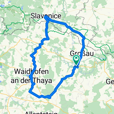
31.07.10 - Einrollrunde an der Thaya
A cycling route starting in Raabs an der Thaya, Lower Austria, Austria.
Overview
About this route
Along the Thaya to Drosendorf, and back over the plateau to Raabs / Thaya.
This route leads over wonderful asphalt and almost without traffic.
- -:--
- Duration
- 27.1 km
- Distance
- 397 m
- Ascent
- 395 m
- Descent
- ---
- Avg. speed
- ---
- Max. altitude

Route quality
Waytypes & surfaces along the route
Waytypes
Road
11.1 km
(41 %)
Quiet road
1.1 km
(4 %)
Undefined
14.9 km
(55 %)
Surfaces
Paved
6.5 km
(24 %)
Asphalt
6 km
(22 %)
Paved (undefined)
0.5 km
(2 %)
Undefined
20.6 km
(76 %)
Continue with Bikemap
Use, edit, or download this cycling route
You would like to ride 31.07.10 - Einrollrunde an der Thaya or customize it for your own trip? Here is what you can do with this Bikemap route:
Free features
- Save this route as favorite or in collections
- Copy & plan your own version of this route
- Sync your route with Garmin or Wahoo
Premium features
Free trial for 3 days, or one-time payment. More about Bikemap Premium.
- Navigate this route on iOS & Android
- Export a GPX / KML file of this route
- Create your custom printout (try it for free)
- Download this route for offline navigation
Discover more Premium features.
Get Bikemap PremiumFrom our community
Other popular routes starting in Raabs an der Thaya
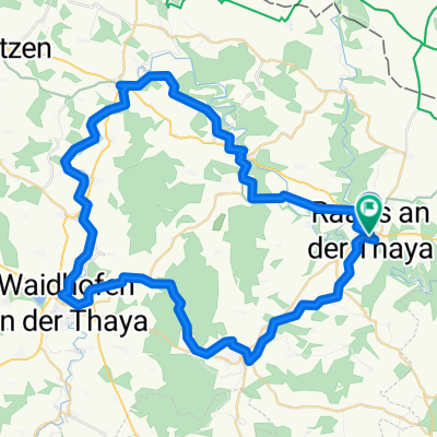
 Thaya Runde
- Distance
- 88.8 km
- Ascent
- 409 m
- Descent
- 410 m
- Location
- Raabs an der Thaya, Lower Austria, Austria
 Burgenrundfahrt im Nördlichen Waldviertel
- Distance
- 79.6 km
- Ascent
- 687 m
- Descent
- 687 m
- Location
- Raabs an der Thaya, Lower Austria, Austria
 Hauptstraße nach Hauptstraße
- Distance
- 63.9 km
- Ascent
- 885 m
- Descent
- 983 m
- Location
- Raabs an der Thaya, Lower Austria, Austria
 thayarunde
- Distance
- 60.5 km
- Ascent
- 789 m
- Descent
- 794 m
- Location
- Raabs an der Thaya, Lower Austria, Austria
 31.07.10 - Einrollrunde an der Thaya
- Distance
- 27.1 km
- Ascent
- 397 m
- Descent
- 395 m
- Location
- Raabs an der Thaya, Lower Austria, Austria
 Modsiedl Drosendorf
- Distance
- 11.1 km
- Ascent
- 108 m
- Descent
- 224 m
- Location
- Raabs an der Thaya, Lower Austria, Austria
 Liebnitz, Raabs an der Thaya nach Modsiedl, Raabs an der Thaya
- Distance
- 28.8 km
- Ascent
- 463 m
- Descent
- 397 m
- Location
- Raabs an der Thaya, Lower Austria, Austria
 Thayarunde Alternative 1 zu Entwurf 4
- Distance
- 60 km
- Ascent
- 546 m
- Descent
- 371 m
- Location
- Raabs an der Thaya, Lower Austria, Austria
Open it in the app