

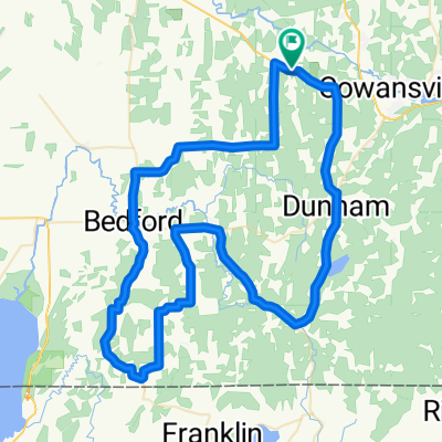
Boucle des Cantons-de-l'Est
A cycling route starting in Cowansville, Quebec, Canada.
Overview
About this route
- -:--
- Duration
- 167.1 km
- Distance
- 973 m
- Ascent
- 971 m
- Descent
- ---
- Avg. speed
- ---
- Max. altitude

Route quality
Waytypes & surfaces along the route
Waytypes
Road
61.8 km
(37 %)
Quiet road
60.1 km
(36 %)
Surfaces
Paved
76.7 km
(46 %)
Unpaved
84.4 km
(51 %)
Unpaved (undefined)
68.3 km
(41 %)
Asphalt
63.3 km
(38 %)
Route highlights
Points of interest along the route
Point of interest after 12.3 km
Ferme d'Alapagas
Point of interest after 19 km
Epicerie et restaurants + casse-croûte
Point of interest after 45.1 km
Dépanneur
Point of interest after 45.3 km
Casse-croûte
Point of interest after 45.6 km
Camping Havre des îles
Point of interest after 54.1 km
Abbaye de Saint-Benoit-Du-Lac
Point of interest after 72.2 km
Magog: épicerie; restaurants & casse-croûte
Point of interest after 100.2 km
Parc national du mont Orford: camping Sépaq - bienvenu cycliste
Point of interest after 134.8 km
Plage public du lac Brome
Point of interest after 136.6 km
Marina de Knowlton : restaurant et bar
Point of interest after 138.4 km
Epicerie
Point of interest after 140.1 km
Section sur la 104 : attention trafic intense!
Point of interest after 146.7 km
Vignoble Domaine Bresee
Point of interest after 153.1 km
Bleuetière Sutton
Continue with Bikemap
Use, edit, or download this cycling route
You would like to ride Boucle des Cantons-de-l'Est or customize it for your own trip? Here is what you can do with this Bikemap route:
Free features
- Save this route as favorite or in collections
- Copy & plan your own version of this route
- Split it into stages to create a multi-day tour
- Sync your route with Garmin or Wahoo
Premium features
Free trial for 3 days, or one-time payment. More about Bikemap Premium.
- Navigate this route on iOS & Android
- Export a GPX / KML file of this route
- Create your custom printout (try it for free)
- Download this route for offline navigation
Discover more Premium features.
Get Bikemap PremiumFrom our community
Other popular routes starting in Cowansville
 Route Vins 18
- Distance
- 28.7 km
- Ascent
- 233 m
- Descent
- 232 m
- Location
- Cowansville, Quebec, Canada
 Garnotte Colline à Patch (gravel bike)
- Distance
- 39.2 km
- Ascent
- 442 m
- Descent
- 441 m
- Location
- Cowansville, Quebec, Canada
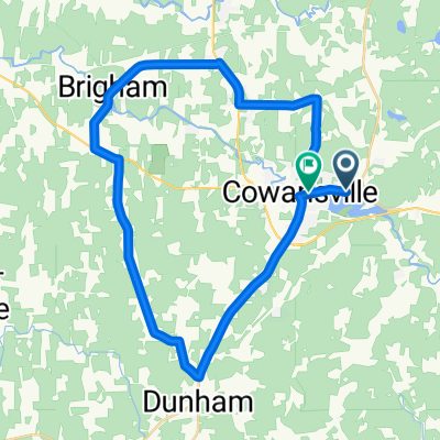
 Routes des Vins
- Distance
- 86.3 km
- Ascent
- 433 m
- Descent
- 438 m
- Location
- Cowansville, Quebec, Canada
 St-Joseph-Beaumont-139-202
- Distance
- 19.8 km
- Ascent
- 106 m
- Descent
- 110 m
- Location
- Cowansville, Quebec, Canada
 43 km - Cowansville (Adamsville et Bromont)
- Distance
- 43.2 km
- Ascent
- 284 m
- Descent
- 284 m
- Location
- Cowansville, Quebec, Canada
 Route des vins
- Distance
- 47.5 km
- Ascent
- 454 m
- Descent
- 454 m
- Location
- Cowansville, Quebec, Canada
 St-Joseph-Noiseux-Janecek
- Distance
- 21.8 km
- Ascent
- 90 m
- Descent
- 94 m
- Location
- Cowansville, Quebec, Canada
 cowansville
- Distance
- 38.5 km
- Ascent
- 165 m
- Descent
- 171 m
- Location
- Cowansville, Quebec, Canada
Open it in the app