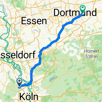
kleine Runde 42,56 km
- 42.6 km
- 36 m
- 38 m
- Sinnersdorf, North Rhine-Westphalia, Germany
A cycling route starting in Sinnersdorf, North Rhine-Westphalia, Germany.
Overview
created this 15 years ago
Route quality
Path
23 km
(62 %)
Road
3 km
(8 %)
Paved
27.1 km
(73 %)
Asphalt
27.1 km
(73 %)
Undefined
10 km
(27 %)
Continue with Bikemap
You would like to ride Sinnersdorf - Quadrath Ichendorf - Brauweiler or customize it for your own trip? Here is what you can do with this Bikemap route:
Free trial for 3 days, or one-time payment. More about Bikemap Premium.
Discover more Premium features.
Get Bikemap PremiumFrom our community
Open it in the app