

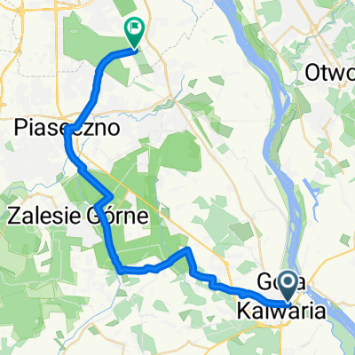
Moczydłów 25, Góra Kalwaria do Jaśminowa 12, Góra Kalwaria
A cycling route starting in Góra Kalwaria, Masovian Voivodeship, Poland.
Overview
About this route
- 1 h 49 min
- Duration
- 26.2 km
- Distance
- 71 m
- Ascent
- 135 m
- Descent
- 14.5 km/h
- Avg. speed
- ---
- Max. altitude

Continue with Bikemap
Use, edit, or download this cycling route
You would like to ride Moczydłów 25, Góra Kalwaria do Jaśminowa 12, Góra Kalwaria or customize it for your own trip? Here is what you can do with this Bikemap route:
Free features
- Save this route as favorite or in collections
- Copy & plan your own version of this route
- Sync your route with Garmin or Wahoo
Premium features
Free trial for 3 days, or one-time payment. More about Bikemap Premium.
- Navigate this route on iOS & Android
- Export a GPX / KML file of this route
- Create your custom printout (try it for free)
- Download this route for offline navigation
Discover more Premium features.
Get Bikemap PremiumFrom our community
Other popular routes starting in Góra Kalwaria
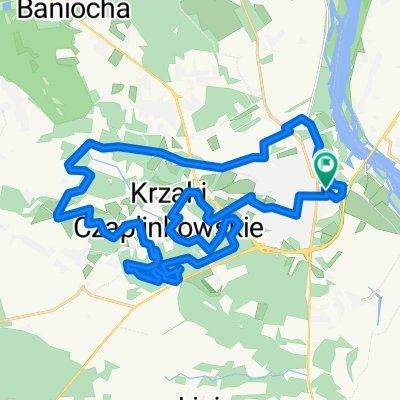
 Góra Kalwaria - Czersk - Otwock
- Distance
- 29.8 km
- Ascent
- 15 m
- Descent
- 28 m
- Location
- Góra Kalwaria, Masovian Voivodeship, Poland
 back to Kabaty
- Distance
- 33.6 km
- Ascent
- 66 m
- Descent
- 67 m
- Location
- Góra Kalwaria, Masovian Voivodeship, Poland
 Czersk 28-06-28
- Distance
- 93.5 km
- Ascent
- 84 m
- Descent
- 82 m
- Location
- Góra Kalwaria, Masovian Voivodeship, Poland
 GK CZERSK BRZUMIN WARKA
- Distance
- 46 km
- Ascent
- 131 m
- Descent
- 121 m
- Location
- Góra Kalwaria, Masovian Voivodeship, Poland
 Szlak Lasów Chojnowskich
- Distance
- 30.2 km
- Ascent
- 41 m
- Descent
- 58 m
- Location
- Góra Kalwaria, Masovian Voivodeship, Poland
 Linin - Sobików - Krupia Wólka - Dobiesz - Baniocha - Słomczyn - G.K - Linin
- Distance
- 49.2 km
- Ascent
- 101 m
- Descent
- 100 m
- Location
- Góra Kalwaria, Masovian Voivodeship, Poland
 Wilkowyje - Mińsk Mazowiecki. Śladami serialu "Rancho"
- Distance
- 95.3 km
- Ascent
- 214 m
- Descent
- 165 m
- Location
- Góra Kalwaria, Masovian Voivodeship, Poland
 księdza Zygmunta Sajny 14, Góra Kalwaria do księdza Zygmunta Sajny 12, Góra Kalwaria
- Distance
- 32 km
- Ascent
- 567 m
- Descent
- 559 m
- Location
- Góra Kalwaria, Masovian Voivodeship, Poland
Open it in the app