

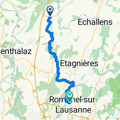
Ruta a Chemin des Bains 1, Echallens
A cycling route starting in Échallens, Canton of Vaud, Switzerland.
Overview
About this route
- 37 min
- Duration
- 8.8 km
- Distance
- 128 m
- Ascent
- 139 m
- Descent
- 14.5 km/h
- Avg. speed
- ---
- Max. altitude
Continue with Bikemap
Use, edit, or download this cycling route
You would like to ride Ruta a Chemin des Bains 1, Echallens or customize it for your own trip? Here is what you can do with this Bikemap route:
Free features
- Save this route as favorite or in collections
- Copy & plan your own version of this route
- Sync your route with Garmin or Wahoo
Premium features
Free trial for 3 days, or one-time payment. More about Bikemap Premium.
- Navigate this route on iOS & Android
- Export a GPX / KML file of this route
- Create your custom printout (try it for free)
- Download this route for offline navigation
Discover more Premium features.
Get Bikemap PremiumFrom our community
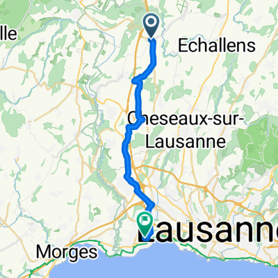
Other popular routes starting in Échallens
 Oulens-Romanel
- Distance
- 13.4 km
- Ascent
- 131 m
- Descent
- 135 m
- Location
- Échallens, Canton of Vaud, Switzerland
 96_Tour du Gros-de-Vaud
- Distance
- 21.1 km
- Ascent
- 269 m
- Descent
- 268 m
- Location
- Échallens, Canton of Vaud, Switzerland
 AStrid03 2021 Villars Wangelen
- Distance
- 134.9 km
- Ascent
- 0 m
- Descent
- 0 m
- Location
- Échallens, Canton of Vaud, Switzerland
 dsgfds
- Distance
- 17.9 km
- Ascent
- 126 m
- Descent
- 316 m
- Location
- Échallens, Canton of Vaud, Switzerland
 Rando des Blés Echallens
- Distance
- 101.9 km
- Ascent
- 813 m
- Descent
- 813 m
- Location
- Échallens, Canton of Vaud, Switzerland
 Sugnens - Moudon - Froideville
- Distance
- 45.1 km
- Ascent
- 638 m
- Descent
- 637 m
- Location
- Échallens, Canton of Vaud, Switzerland
 Sugnens_Etagnières 32km
- Distance
- 32.3 km
- Ascent
- 407 m
- Descent
- 430 m
- Location
- Échallens, Canton of Vaud, Switzerland
 Rando de blé
- Distance
- 100.3 km
- Ascent
- 877 m
- Descent
- 879 m
- Location
- Échallens, Canton of Vaud, Switzerland
Open it in the app