Kartuska 42, Gowidlino do Droga Krajowa 6 5, God臋towo
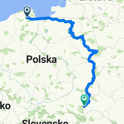
A cycling route starting in Gmina Sierakowice, Pomeranian Voivodeship, Poland.
Overview
About this route
- -:--
- Duration
- 36.9 km
- Distance
- 124 m
- Ascent
- 261 m
- Descent
- ---
- Avg. speed
- ---
- Avg. speed
Route quality
Waytypes & surfaces along the route
Waytypes
Road
18.4 km
(50 %)
Quiet road
10.9 km
(30 %)
Surfaces
Paved
8.7 km
(24 %)
Unpaved
13.2 km
(36 %)
Asphalt
8.7 km
(24 %)
Unpaved (undefined)
7.3 km
(20 %)
Continue with Bikemap
Use, edit, or download this cycling route
You would like to ride Kartuska 42, Gowidlino do Droga Krajowa 6 5, God臋towo or customize it for your own trip? Here is what you can do with this Bikemap route:
Free features
- Save this route as favorite or in collections
- Copy & plan your own version of this route
- Sync your route with Garmin or Wahoo
Premium features
Free trial for 3 days, or one-time payment. More about Bikemap Premium.
- Navigate this route on iOS & Android
- Export a GPX / KML file of this route
- Create your custom printout (try it for free)
- Download this route for offline navigation
Discover more Premium features.
Get Bikemap PremiumFrom our community
Other popular routes starting in Gmina Sierakowice
- Wzd艂u偶 Polski Wschodniej i nie tylko:) (2010)
- Distance
- 1,240.2 km
- Ascent
- 595 m
- Descent
- 614 m
- Location
- Gmina Sierakowice, Pomeranian Voivodeship, Poland
- 艢wierkowa 3 - Przyrowie - Las - Truskawkowa - Dom
- Distance
- 7.1 km
- Ascent
- 76 m
- Descent
- 76 m
- Location
- Gmina Sierakowice, Pomeranian Voivodeship, Poland
- Wycieczka rowerowa na Hel (2007)
- Distance
- 173.9 km
- Ascent
- 372 m
- Descent
- 590 m
- Location
- Gmina Sierakowice, Pomeranian Voivodeship, Poland
- Kamienica Szlachecka - Spacer
- Distance
- 4.8 km
- Ascent
- 30 m
- Descent
- 30 m
- Location
- Gmina Sierakowice, Pomeranian Voivodeship, Poland
- Trasa test kr贸tsza
- Distance
- 35.8 km
- Ascent
- 209 m
- Descent
- 209 m
- Location
- Gmina Sierakowice, Pomeranian Voivodeship, Poland
- Wok贸艂 jeziora
- Distance
- 27.4 km
- Ascent
- 165 m
- Descent
- 166 m
- Location
- Gmina Sierakowice, Pomeranian Voivodeship, Poland
- wzd艂u偶 polskiego wybrze偶a do 艢winouj艣cia (2009)
- Distance
- 343.6 km
- Ascent
- 215 m
- Descent
- 433 m
- Location
- Gmina Sierakowice, Pomeranian Voivodeship, Poland
- Route to Marsza艂ka J贸zefa Pi艂sudskiego 19, 83-340 Sierakowice
- Distance
- 7.6 km
- Ascent
- 47 m
- Descent
- 51 m
- Location
- Gmina Sierakowice, Pomeranian Voivodeship, Poland
Open it in the app