À vélo autour deMontigny-le-Bretonneux
A cycling route starting in Saint-Quentin-en-Yvelines, Île-de-France Region, France.
Overview
About this route
- -:--
- Duration
- 17.4 km
- Distance
- 110 m
- Ascent
- 104 m
- Descent
- ---
- Avg. speed
- ---
- Avg. speed
Route quality
Waytypes & surfaces along the route
Waytypes
Quiet road
8.3 km
(48 %)
Road
4.4 km
(25 %)
Surfaces
Paved
11 km
(63 %)
Unpaved
0.8 km
(5 %)
Asphalt
11 km
(63 %)
Ground
0.8 km
(5 %)
Undefined
5.6 km
(32 %)
Continue with Bikemap
Use, edit, or download this cycling route
You would like to ride À vélo autour deMontigny-le-Bretonneux or customize it for your own trip? Here is what you can do with this Bikemap route:
Free features
- Save this route as favorite or in collections
- Copy & plan your own version of this route
- Sync your route with Garmin or Wahoo
Premium features
Free trial for 3 days, or one-time payment. More about Bikemap Premium.
- Navigate this route on iOS & Android
- Export a GPX / KML file of this route
- Create your custom printout (try it for free)
- Download this route for offline navigation
Discover more Premium features.
Get Bikemap PremiumFrom our community
Other popular routes starting in Saint-Quentin-en-Yvelines
- 2 Rue de Chateaubriand, Montigny-le-Bretonneux à 13 Avenue de la Source, Montigny-le-Bretonneux
- Distance
- 24.2 km
- Ascent
- 1,571 m
- Descent
- 1,573 m
- Location
- Saint-Quentin-en-Yvelines, Île-de-France Region, France
- entrainement
- Distance
- 39.9 km
- Ascent
- 331 m
- Descent
- 332 m
- Location
- Saint-Quentin-en-Yvelines, Île-de-France Region, France
- 61 Avenue du Manet, Montigny-le-Bretonneux à Guyancourt
- Distance
- 5.7 km
- Ascent
- 71 m
- Descent
- 78 m
- Location
- Saint-Quentin-en-Yvelines, Île-de-France Region, France
- Sortie VTT 45 km
- Distance
- 53.6 km
- Ascent
- 435 m
- Descent
- 435 m
- Location
- Saint-Quentin-en-Yvelines, Île-de-France Region, France
- De Rue d'Alsace Lorraine 56, Montigny-le-Bretonneux à Rue d'Alsace Lorraine 54, Montigny-le-Bretonneux
- Distance
- 41.8 km
- Ascent
- 453 m
- Descent
- 453 m
- Location
- Saint-Quentin-en-Yvelines, Île-de-France Region, France
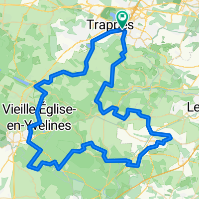
- Montigny-le-Bretonneux à Montigny-le-Bretonneux
- Distance
- 39.5 km
- Ascent
- 581 m
- Descent
- 581 m
- Location
- Saint-Quentin-en-Yvelines, Île-de-France Region, France
- De Route de Trappes 4, Montigny-le-Bretonneux à Route de Trappes 4, Montigny-le-Bretonneux
- Distance
- 86 km
- Ascent
- 1,094 m
- Descent
- 1,094 m
- Location
- Saint-Quentin-en-Yvelines, Île-de-France Region, France
- 3R Rando 54km
- Distance
- 54 km
- Ascent
- 799 m
- Descent
- 802 m
- Location
- Saint-Quentin-en-Yvelines, Île-de-France Region, France
Open it in the app