Brunnersberg-Brocheten-Katertürli
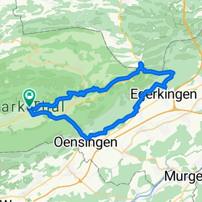
A cycling route starting in Laupersdorf, Canton of Solothurn, Switzerland.
Overview
About this route
Nach angemessenem Aufstieg bietet die Route eine sehr schöne und schnelle Abfahrt über Brocheten und Scheltenstrasse nach Mümliswil. Sehr gut auch nach dem Arbeiten am Abend noch zu fahren oder nach einem kleinerem Kater vom Vorabend :-)
- -:--
- Duration
- 26.7 km
- Distance
- 636 m
- Ascent
- 650 m
- Descent
- ---
- Avg. speed
- ---
- Avg. speed
Route quality
Waytypes & surfaces along the route
Waytypes
Quiet road
12.5 km
(47 %)
Busy road
9 km
(34 %)
Surfaces
Paved
18 km
(67 %)
Unpaved
1.1 km
(4 %)
Asphalt
18 km
(67 %)
Loose gravel
0.8 km
(3 %)
Continue with Bikemap
Use, edit, or download this cycling route
You would like to ride Brunnersberg-Brocheten-Katertürli or customize it for your own trip? Here is what you can do with this Bikemap route:
Free features
- Save this route as favorite or in collections
- Copy & plan your own version of this route
- Sync your route with Garmin or Wahoo
Premium features
Free trial for 3 days, or one-time payment. More about Bikemap Premium.
- Navigate this route on iOS & Android
- Export a GPX / KML file of this route
- Create your custom printout (try it for free)
- Download this route for offline navigation
Discover more Premium features.
Get Bikemap PremiumFrom our community
Other popular routes starting in Laupersdorf
- Scheltenpass-Passwang-Allerheiligen-Olten
- Distance
- 51.4 km
- Ascent
- 1,216 m
- Descent
- 1,495 m
- Location
- Laupersdorf, Canton of Solothurn, Switzerland
- Hellchöpfli
- Distance
- 24 km
- Ascent
- 805 m
- Descent
- 805 m
- Location
- Laupersdorf, Canton of Solothurn, Switzerland
- Brunnersberg-Lätt Türli
- Distance
- 18.6 km
- Ascent
- 582 m
- Descent
- 583 m
- Location
- Laupersdorf, Canton of Solothurn, Switzerland
- Oberberg-Bremgarten-Schanzenwägli-Tour
- Distance
- 19 km
- Ascent
- 532 m
- Descent
- 529 m
- Location
- Laupersdorf, Canton of Solothurn, Switzerland
- jura215
- Distance
- 215 km
- Ascent
- 3,130 m
- Descent
- 3,131 m
- Location
- Laupersdorf, Canton of Solothurn, Switzerland
- Laupersdorf-Bärenwil-Oensingen-Laupersdorf
- Distance
- 34.1 km
- Ascent
- 744 m
- Descent
- 744 m
- Location
- Laupersdorf, Canton of Solothurn, Switzerland
- Laupersdorf, Alp, Bluemlismatt, Holderbank, Laupersdorf
- Distance
- 31.7 km
- Ascent
- 798 m
- Descent
- 798 m
- Location
- Laupersdorf, Canton of Solothurn, Switzerland
- Laupersdorf, Brunnersberg ,Mümliswil, lpd
- Distance
- 27.4 km
- Ascent
- 852 m
- Descent
- 852 m
- Location
- Laupersdorf, Canton of Solothurn, Switzerland