

Schluchtensteig Schwarzwald
A cycling route starting in Schleitheim, Canton of Schaffhausen, Switzerland.
Overview
About this route
Wandern quer durch den Naturpark Südschwarzwald – Deutschlands Schönster Weitwanderweg 2011
- -:--
- Duration
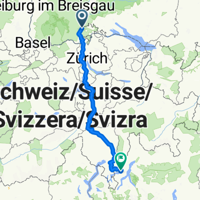
- 103.8 km
- Distance
- 4,040 m
- Ascent
- 4,146 m
- Descent
- ---
- Avg. speed
- ---
- Max. altitude
Continue with Bikemap
Use, edit, or download this cycling route
You would like to ride Schluchtensteig Schwarzwald or customize it for your own trip? Here is what you can do with this Bikemap route:
Free features
- Save this route as favorite or in collections
- Copy & plan your own version of this route
- Split it into stages to create a multi-day tour
- Sync your route with Garmin or Wahoo
Premium features
Free trial for 3 days, or one-time payment. More about Bikemap Premium.
- Navigate this route on iOS & Android
- Export a GPX / KML file of this route
- Create your custom printout (try it for free)
- Download this route for offline navigation
Discover more Premium features.
Get Bikemap PremiumFrom our community
Other popular routes starting in Schleitheim
 Route nach Porlezza
- Distance
- 331.3 km
- Ascent
- 11,512 m
- Descent
- 11,665 m
- Location
- Schleitheim, Canton of Schaffhausen, Switzerland
 Tag 8 - Siblingen - Freiburg Brsg.
- Distance
- 91.7 km
- Ascent
- 1,170 m
- Descent
- 1,500 m
- Location
- Schleitheim, Canton of Schaffhausen, Switzerland
 Teilst RB
- Distance
- 13.6 km
- Ascent
- 436 m
- Descent
- 495 m
- Location
- Schleitheim, Canton of Schaffhausen, Switzerland
 Schluchtensteig Schwarzwald
- Distance
- 103.8 km
- Ascent
- 4,040 m
- Descent
- 4,146 m
- Location
- Schleitheim, Canton of Schaffhausen, Switzerland
 Stühlingen/Hagenturm
- Distance
- 32.3 km
- Ascent
- 573 m
- Descent
- 573 m
- Location
- Schleitheim, Canton of Schaffhausen, Switzerland
 Hagenturm
- Distance
- 13.6 km
- Ascent
- 42 m
- Descent
- 524 m
- Location
- Schleitheim, Canton of Schaffhausen, Switzerland
 Sthulingen - Wallbach
- Distance
- 67.9 km
- Ascent
- 234 m
- Descent
- 421 m
- Location
- Schleitheim, Canton of Schaffhausen, Switzerland
 Randentour BKS Marathon
- Distance
- 64.9 km
- Ascent
- 1,150 m
- Descent
- 1,150 m
- Location
- Schleitheim, Canton of Schaffhausen, Switzerland
Open it in the app