
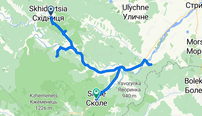
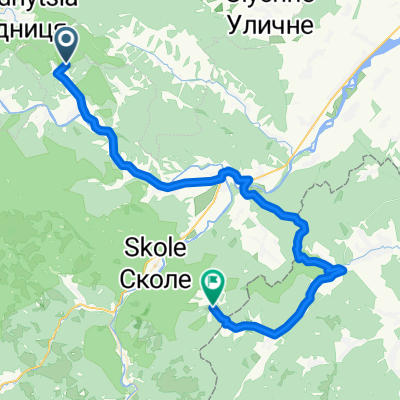
Urych - Skole
A cycling route starting in Skhidnytsia, Lviv Oblast, Ukraine.
Overview
About this route
- -:--
- Duration
- 71.1 km
- Distance
- 322 m
- Ascent
- 455 m
- Descent
- ---
- Avg. speed
- ---
- Max. altitude

Route highlights
Points of interest along the route
Point of interest after 6.4 km
Rocks Tustan
Accommodation after 17.9 km
Camping
Accommodation after 17.9 km
Camping
Accommodation after 17.9 km
Camping
Accommodation after 17.9 km
Camping
Accommodation after 17.9 km
Camping
Photo after 17.9 km
Waterfall Sopit
Accommodation after 44.2 km
Camping
Photo after 50.1 km
Photo after 51 km
Accommodation after 58.9 km
Camping
Accommodation after 66.7 km
Camping
Accommodation after 67 km
Camping
Photo after 69.2 km
Accommodation after 71 km
Camping
Accommodation after 71.1 km
Camping
Accommodation after 71.1 km
Camping
Continue with Bikemap
Use, edit, or download this cycling route
You would like to ride Urych - Skole or customize it for your own trip? Here is what you can do with this Bikemap route:
Free features
- Save this route as favorite or in collections
- Copy & plan your own version of this route
- Sync your route with Garmin or Wahoo
Premium features
Free trial for 3 days, or one-time payment. More about Bikemap Premium.
- Navigate this route on iOS & Android
- Export a GPX / KML file of this route
- Create your custom printout (try it for free)
- Download this route for offline navigation
Discover more Premium features.
Get Bikemap PremiumFrom our community
Other popular routes starting in Skhidnytsia
 Route from вулиця Зарічна 21, Східниця
- Distance
- 8.8 km
- Ascent
- 427 m
- Descent
- 32 m
- Location
- Skhidnytsia, Lviv Oblast, Ukraine
 Старий Тартак - Сопіт - Урич - Трускавець
- Distance
- 48.8 km
- Ascent
- 820 m
- Descent
- 964 m
- Location
- Skhidnytsia, Lviv Oblast, Ukraine
 Recovered Route
- Distance
- 0.6 km
- Ascent
- 13 m
- Descent
- 59 m
- Location
- Skhidnytsia, Lviv Oblast, Ukraine
 gdfgdfg
- Distance
- 104.8 km
- Ascent
- 936 m
- Descent
- 797 m
- Location
- Skhidnytsia, Lviv Oblast, Ukraine
 Східниця - Львів
- Distance
- 90.2 km
- Ascent
- 408 m
- Descent
- 649 m
- Location
- Skhidnytsia, Lviv Oblast, Ukraine
 Urych - Skole
- Distance
- 71.1 km
- Ascent
- 322 m
- Descent
- 455 m
- Location
- Skhidnytsia, Lviv Oblast, Ukraine
 Schodnica - Rybnik
- Distance
- 27.7 km
- Ascent
- 242 m
- Descent
- 333 m
- Location
- Skhidnytsia, Lviv Oblast, Ukraine
 2 деньТустань-Камянка
- Distance
- 54.6 km
- Ascent
- 736 m
- Descent
- 690 m
- Location
- Skhidnytsia, Lviv Oblast, Ukraine
Open it in the app