

Orbetello-Vulci-Marta (lago Bolsena)
A cycling route starting in Orbetello Scalo, Tuscany, Italy.
Overview
About this route
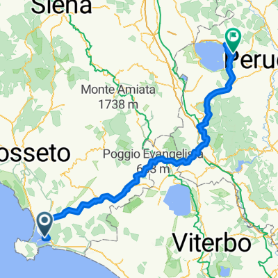
1st stage of the MTB cycling trip that will take us from Orbetello, on the Tyrrhenian Sea, to Porto d'Ascoli, on the Adriatic Sea. We leave Orbetello following the bike path that crosses the bridge over the lagoon. We turn left towards Porto Ercole and enter the dirt path in the Feniglia Reserve which takes us to Ansedonia. We reach the 'Spacco della Regina' and the 'Tagliata Etrusca', then follow the sea southwards, first on the coastal path (if passable) then on the coastal road until the junction for the Capalbio campsite and 'Ultima Spiaggia'. We reach Pescia Romana, then take Strada Querciolaia which, with a long dirt section as well, takes us to Vulci. Attention!!! The dirt section is clayey, so if there has been recent rain, it becomes difficult to pass. Make sure to study an alternative route. We cross the magnificent medieval bridge leading to the Castle of Abbadia. We now continue towards Canino, pass through Tessenano, and arrive at Lake Bolsena in Capodimonte and Marta.
- 7 h 29 min
- Duration
- 91.5 km
- Distance
- 862 m
- Ascent
- 546 m
- Descent
- 12.2 km/h
- Avg. speed
- ---
- Max. altitude

Route quality
Waytypes & surfaces along the route
Waytypes
Road
28.4 km
(31 %)
Quiet road
22.9 km
(25 %)
Surfaces
Paved
37.5 km
(41 %)
Unpaved
7.3 km
(8 %)
Asphalt
31.1 km
(34 %)
Gravel
5.5 km
(6 %)
Continue with Bikemap
Use, edit, or download this cycling route
You would like to ride Orbetello-Vulci-Marta (lago Bolsena) or customize it for your own trip? Here is what you can do with this Bikemap route:
Free features
- Save this route as favorite or in collections
- Copy & plan your own version of this route
- Split it into stages to create a multi-day tour
- Sync your route with Garmin or Wahoo
Premium features
Free trial for 3 days, or one-time payment. More about Bikemap Premium.
- Navigate this route on iOS & Android
- Export a GPX / KML file of this route
- Create your custom printout (try it for free)
- Download this route for offline navigation
Discover more Premium features.
Get Bikemap PremiumFrom our community
Other popular routes starting in Orbetello Scalo
 Ortebello - Magione
- Distance
- 193.1 km
- Ascent
- 2,742 m
- Descent
- 2,425 m
- Location
- Orbetello Scalo, Tuscany, Italy
 Ansedonia - Porto Ercole - Cosa - Ansedonia
- Distance
- 22.8 km
- Ascent
- 188 m
- Descent
- 184 m
- Location
- Orbetello Scalo, Tuscany, Italy
 Orbetello-Vulci-Marta (lago Bolsena)
- Distance
- 91.5 km
- Ascent
- 862 m
- Descent
- 546 m
- Location
- Orbetello Scalo, Tuscany, Italy
 Orbetello
- Distance
- 18.5 km
- Ascent
- 17 m
- Descent
- 20 m
- Location
- Orbetello Scalo, Tuscany, Italy
 orbetello - manciano - canino - tuscania - roma termini
- Distance
- 178.7 km
- Ascent
- 1,148 m
- Descent
- 1,091 m
- Location
- Orbetello Scalo, Tuscany, Italy
 Orbetello-Capalbio-Manciano-Marta (lago di Bolsena)
- Distance
- 106.7 km
- Ascent
- 1,002 m
- Descent
- 681 m
- Location
- Orbetello Scalo, Tuscany, Italy
 Orbetello-Lago di Bolsena-Spoleto-Norcia-Ancona
- Distance
- 463.9 km
- Ascent
- 3,686 m
- Descent
- 3,684 m
- Location
- Orbetello Scalo, Tuscany, Italy
 Orbetello, Monte Argentario e Duna Feniglia
- Distance
- 37.9 km
- Ascent
- 715 m
- Descent
- 717 m
- Location
- Orbetello Scalo, Tuscany, Italy
Open it in the app