

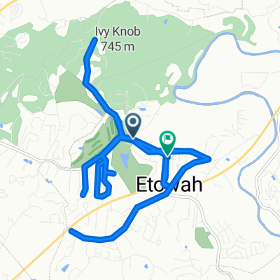
Dupont Loop - Hooker, Hickory, Ridgeline, Issac, Hilltop
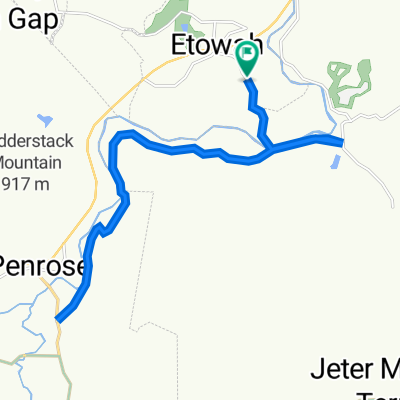
A cycling route starting in Etowah, North Carolina, United States.
Overview
About this route
- -:--
- Duration
- 15.4 km
- Distance
- 327 m
- Ascent
- 328 m
- Descent
- ---
- Avg. speed
- ---
- Max. altitude

Route quality
Waytypes & surfaces along the route
Waytypes
Path
10.9 km
(71 %)
Track
4.6 km
(29 %)
Undefined
-0 km
(<1 %)
Surfaces
Unpaved
3.9 km
(25 %)
Unpaved (undefined)
3 km
(19 %)
Ground
0.6 km
(4 %)
Route highlights
Points of interest along the route
Point of interest after 12 km
Waterfall
Continue with Bikemap
Use, edit, or download this cycling route
You would like to ride Dupont Loop - Hooker, Hickory, Ridgeline, Issac, Hilltop or customize it for your own trip? Here is what you can do with this Bikemap route:
Free features
- Save this route as favorite or in collections
- Copy & plan your own version of this route
- Sync your route with Garmin or Wahoo
Premium features
Free trial for 3 days, or one-time payment. More about Bikemap Premium.
- Navigate this route on iOS & Android
- Export a GPX / KML file of this route
- Create your custom printout (try it for free)
- Download this route for offline navigation
Discover more Premium features.
Get Bikemap PremiumFrom our community
Other popular routes starting in Etowah
 Dupont Loop - Hooker, Hickory, Ridgeline, Issac, Hilltop
- Distance
- 15.4 km
- Ascent
- 327 m
- Descent
- 328 m
- Location
- Etowah, North Carolina, United States
 Fast ride in Etowah
- Distance
- 14.4 km
- Ascent
- 247 m
- Descent
- 235 m
- Location
- Etowah, North Carolina, United States
 Rocky Ridge to Ridgeline Shuttle - Dupont State Forest
- Distance
- 6.8 km
- Ascent
- 102 m
- Descent
- 286 m
- Location
- Etowah, North Carolina, United States
 big16
big16- Distance
- 26.2 km
- Ascent
- 506 m
- Descent
- 503 m
- Location
- Etowah, North Carolina, United States
 17.8 Etowah Park_Pleasant
- Distance
- 28.6 km
- Ascent
- 362 m
- Descent
- 360 m
- Location
- Etowah, North Carolina, United States
 1–99 Ewbank Rd, Etowah to 233 Brickyard Rd, Etowah
- Distance
- 22.3 km
- Ascent
- 1,411 m
- Descent
- 1,408 m
- Location
- Etowah, North Carolina, United States
 Hendersonville
- Distance
- 56.3 km
- Ascent
- 631 m
- Descent
- 632 m
- Location
- Etowah, North Carolina, United States
 Turkey Pen - S Mills, Buckhorn Gap, U/M Black, Turkey Pen Ridge
- Distance
- 32.2 km
- Ascent
- 688 m
- Descent
- 688 m
- Location
- Etowah, North Carolina, United States
Open it in the app