

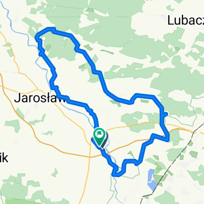
Powolna trasa w Stubno
A cycling route starting in Sośnica, Subcarpathian Voivodeship, Poland.
Overview
About this route
- 1 h 22 min
- Duration
- 19.8 km
- Distance
- 28 m
- Ascent
- 63 m
- Descent
- 14.5 km/h
- Avg. speed
- ---
- Max. altitude

Route quality
Waytypes & surfaces along the route
Waytypes
Road
15.7 km
(79 %)
Pedestrian area
1.6 km
(8 %)
Surfaces
Paved
17.1 km
(86 %)
Asphalt
17.1 km
(86 %)
Undefined
2.8 km
(14 %)
Continue with Bikemap
Use, edit, or download this cycling route
You would like to ride Powolna trasa w Stubno or customize it for your own trip? Here is what you can do with this Bikemap route:
Free features
- Save this route as favorite or in collections
- Copy & plan your own version of this route
- Sync your route with Garmin or Wahoo
Premium features
Free trial for 3 days, or one-time payment. More about Bikemap Premium.
- Navigate this route on iOS & Android
- Export a GPX / KML file of this route
- Create your custom printout (try it for free)
- Download this route for offline navigation
Discover more Premium features.
Get Bikemap PremiumFrom our community
Other popular routes starting in Sośnica
 Zadąbrowie 127, Orły do Zadąbrowie 127, Orły
- Distance
- 8.1 km
- Ascent
- 7 m
- Descent
- 10 m
- Location
- Sośnica, Subcarpathian Voivodeship, Poland
 Unnamed Road do Przemyśl
- Distance
- 19 km
- Ascent
- 127 m
- Descent
- 114 m
- Location
- Sośnica, Subcarpathian Voivodeship, Poland
 A 4, Radymno do Bankowa 8A, Żurawica
- Distance
- 31.1 km
- Ascent
- 128 m
- Descent
- 114 m
- Location
- Sośnica, Subcarpathian Voivodeship, Poland
 Route in Gmina Radymno
- Distance
- 109 km
- Ascent
- 255 m
- Descent
- 256 m
- Location
- Sośnica, Subcarpathian Voivodeship, Poland
 Unnamed Road do 143B, Wyszatyce
- Distance
- 71.1 km
- Ascent
- 231 m
- Descent
- 238 m
- Location
- Sośnica, Subcarpathian Voivodeship, Poland
 Powolna trasa w Stubno
- Distance
- 19.8 km
- Ascent
- 28 m
- Descent
- 63 m
- Location
- Sośnica, Subcarpathian Voivodeship, Poland
 Unnamed Road do , Wyszatyce
- Distance
- 73.1 km
- Ascent
- 307 m
- Descent
- 308 m
- Location
- Sośnica, Subcarpathian Voivodeship, Poland
 Radymno gmina, Radymno do A4, Stubno
- Distance
- 7.8 km
- Ascent
- 15 m
- Descent
- 3 m
- Location
- Sośnica, Subcarpathian Voivodeship, Poland
Open it in the app