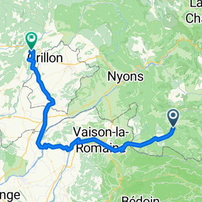
Circuit 3 Buis - Gorges de la Nesque - Buis par Malaucène
- 122 km
- 1,099 m
- 1,097 m
- Buis-les-Baronnies, Auvergne-Rhône-Alpes, France
sainte Jalle 2020
A cycling route starting in Buis-les-Baronnies, Auvergne-Rhône-Alpes, France.
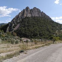
Overview
test track around Col Lachaud to test,
no not bike-friendly, surprisingly good to walk in cycling shoes
created this 5 years ago
Part of
3 stages
Route quality
Road
35.1 km
(39 %)
Quiet road
11.7 km
(13 %)
Paved
37.9 km
(42 %)
Asphalt
37.9 km
(42 %)
Undefined
52.3 km
(58 %)
Continue with Bikemap
You would like to ride 28.06.2020 Chez Alice or customize it for your own trip? Here is what you can do with this Bikemap route:
Free trial for 3 days, or one-time payment. More about Bikemap Premium.
Discover more Premium features.
Get Bikemap PremiumFrom our community
Open it in the app