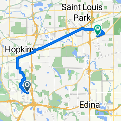
Wisconsin Tour summary
A cycling route starting in Edina, Minnesota, United States of America.
Overview
About this route
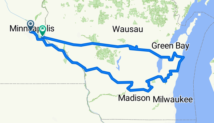
This is the summary trace for our 1,000-mile bike tour in 2010. As plotted here, it falls a bit short of 1,000 miles --- but every day had a few detours, a few errands to run, and the like. So our actual odometer-measured and GPS-measured distance traveled was 1008 miles.
- -:--
- Duration
- 1,520 km
- Distance
- 694 m
- Ascent
- 688 m
- Descent
- ---
- Avg. speed
- ---
- Max. altitude
Route quality
Waytypes & surfaces along the route
Waytypes
Quiet road
473.4 km
(31 %)
Road
352 km
(23 %)
Surfaces
Paved
290.4 km
(19 %)
Unpaved
151.7 km
(10 %)
Asphalt
169.5 km
(11 %)
Gravel
119.5 km
(8 %)
Continue with Bikemap
Use, edit, or download this cycling route
You would like to ride Wisconsin Tour summary or customize it for your own trip? Here is what you can do with this Bikemap route:
Free features
- Save this route as favorite or in collections
- Copy & plan your own version of this route
- Split it into stages to create a multi-day tour
- Sync your route with Garmin or Wahoo
Premium features
Free trial for 3 days, or one-time payment. More about Bikemap Premium.
- Navigate this route on iOS & Android
- Export a GPX / KML file of this route
- Create your custom printout (try it for free)
- Download this route for offline navigation
Discover more Premium features.
Get Bikemap PremiumFrom our community
Other popular routes starting in Edina
- Commute Via Creek
- Distance
- 18.3 km
- Ascent
- 107 m
- Descent
- 116 m
- Location
- Edina, Minnesota, United States of America
- B2B00708 55410 > 55406 via Xerxes Ave, Midtown Greenway
- Distance
- 12.5 km
- Ascent
- 32 m
- Descent
- 41 m
- Location
- Edina, Minnesota, United States of America
- Fun Lake Ride
- Distance
- 57 km
- Ascent
- 104 m
- Descent
- 103 m
- Location
- Edina, Minnesota, United States of America
- Open Streets Jul 23 2017
- Distance
- 27.8 km
- Ascent
- 76 m
- Descent
- 76 m
- Location
- Edina, Minnesota, United States of America
- via Midtown Greenway, Park Ave
- Distance
- 13.8 km
- Ascent
- 30 m
- Descent
- 35 m
- Location
- Edina, Minnesota, United States of America
- Wisconsin Tour summary
- Distance
- 1,520 km
- Ascent
- 694 m
- Descent
- 688 m
- Location
- Edina, Minnesota, United States of America
- Minn River/Hyland Preserve
- Distance
- 33.1 km
- Ascent
- 175 m
- Descent
- 195 m
- Location
- Edina, Minnesota, United States of America
- B2B00676 55439 > 55403 via Blake Rd, Kenilworth Trail
- Distance
- 17.9 km
- Ascent
- 69 m
- Descent
- 77 m
- Location
- Edina, Minnesota, United States of America
Open it in the app