

RALLYE DE LA MARMOTTE
RALLYE DE LA MARMOTTE
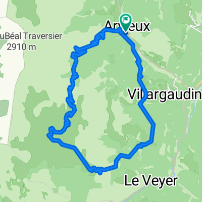
A cycling route starting in Guillestre, Provence-Alpes-Côte d'Azur Region, France.
Overview
About this route
'Upon waking in April 2020... Griotte was all turned upside down!
Just emerging from her burrow in the heart of the Queyras, there was incredible silence! No one around, no pollution in the air, animals everywhere, and delicious wildflowers...
She thought she was still dreaming...
Without hesitation, she went into the valley to meet her cousins who live in the Sacred Marmot Mountain. Maybe they could give her some answers???
Unfortunately, very tired after crossing the terrible Gorges du Guil on foot and then rafting alone, Griotte no longer remembered the last stretch of the path... So she decided to finish her extraordinary adventure by bike...
Follow her tracks and meet up within 5 hours at her cousins' place...
- -:--
- Duration
- 26.6 km
- Distance
- 293 m
- Ascent
- 293 m
- Descent
- ---
- Avg. speed
- ---
- Max. altitude

Part of
RALLYE DE LA MARMOTTE
1 stage
Route photos


Route quality
Waytypes & surfaces along the route
Waytypes
Quiet road
7.4 km
(28 %)
Track
6.9 km
(26 %)
Surfaces
Paved
11.2 km
(42 %)
Unpaved
7.2 km
(27 %)
Asphalt
10.4 km
(39 %)
Gravel
4.8 km
(18 %)
Route highlights
Points of interest along the route

Bike service after 0 km
GUIL-EBIKE SHOP
Point of interest after 0.7 km
ANCIENS FOURS A CHAUX

Point of interest after 1.7 km
MAIN DU TITAN

Point of interest after 3.1 km
PONT DU SIMOUST

Point of interest after 4.1 km
LA FONT D'EYGLIERS

Point of interest after 7.7 km
ARSENAL

Point of interest after 8.3 km
ECHAUGUETTE EST

Point of interest after 8.6 km
CASERNE CAMPANA

Point of interest after 8.7 km
PORTE DE BRIANCON
Point of interest after 9.9 km
EGLISE ST ANTOINE

Point of interest after 12.7 km
TORRENT DU MERDANEL

Point of interest after 15 km
ST CREPIN - VILLAGE ESCARGOT
Drinking water after 17.1 km
Point of interest after 18.4 km
POINT 893 / PRAIRIE LARGE RELIANT 2 CHEMINS

Point of interest after 21.5 km
FONTAINE PETRIFIANTE

Point of interest after 23.7 km
BERGES DE DURANCE

Point of interest after 26 km
MONTAGNE SACRÉE DES MARMOTTES - DOMICILE DES COUSINS DE GRIOTTE
Continue with Bikemap
Use, edit, or download this cycling route
You would like to ride RALLYE DE LA MARMOTTE or customize it for your own trip? Here is what you can do with this Bikemap route:
Free features
- Save this route as favorite or in collections
- Copy & plan your own version of this route
- Sync your route with Garmin or Wahoo
Premium features
Free trial for 3 days, or one-time payment. More about Bikemap Premium.
- Navigate this route on iOS & Android
- Export a GPX / KML file of this route
- Create your custom printout (try it for free)
- Download this route for offline navigation
Discover more Premium features.
Get Bikemap PremiumFrom our community
Other popular routes starting in Guillestre
 CeillacRiailleCristillan
- Distance
- 62.4 km
- Ascent
- 1,624 m
- Descent
- 1,624 m
- Location
- Guillestre, Provence-Alpes-Côte d'Azur Region, France
 LesGorgesduGuil
- Distance
- 17.9 km
- Ascent
- 481 m
- Descent
- 479 m
- Location
- Guillestre, Provence-Alpes-Côte d'Azur Region, France
 N°15:LeLacduPréduLaus (DépartRisoulStation)
- Distance
- 9.2 km
- Ascent
- 261 m
- Descent
- 262 m
- Location
- Guillestre, Provence-Alpes-Côte d'Azur Region, France
 Tour de Furfande
- Distance
- 23 km
- Ascent
- 1,077 m
- Descent
- 1,077 m
- Location
- Guillestre, Provence-Alpes-Côte d'Azur Region, France
 018 - 2014
- Distance
- 77.7 km
- Ascent
- 1,637 m
- Descent
- 2,039 m
- Location
- Guillestre, Provence-Alpes-Côte d'Azur Region, France
 CeillacRiailleCristillan(DuChalet)
- Distance
- 51.2 km
- Ascent
- 1,937 m
- Descent
- 1,936 m
- Location
- Guillestre, Provence-Alpes-Côte d'Azur Region, France
 CeillacRiailleCristillan (unpeu+route)
- Distance
- 59.6 km
- Ascent
- 2,087 m
- Descent
- 2,088 m
- Location
- Guillestre, Provence-Alpes-Côte d'Azur Region, France
 CeillacMelezetCristillian
- Distance
- 52.9 km
- Ascent
- 1,456 m
- Descent
- 1,456 m
- Location
- Guillestre, Provence-Alpes-Côte d'Azur Region, France
Open it in the app