

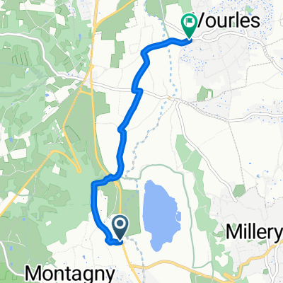
Charly
A cycling route starting in Montagny, Auvergne-Rhône-Alpes, France.
Overview
About this route
- -:--
- Duration
- 24.5 km
- Distance
- 402 m
- Ascent
- 399 m
- Descent
- ---
- Avg. speed
- ---
- Max. altitude

Route quality
Waytypes & surfaces along the route
Waytypes
Road
8.9 km
(36 %)
Quiet road
7.1 km
(29 %)
Surfaces
Paved
3 km
(12 %)
Unpaved
3.5 km
(14 %)
Asphalt
3 km
(12 %)
Gravel
2.5 km
(10 %)
Continue with Bikemap
Use, edit, or download this cycling route
You would like to ride Charly or customize it for your own trip? Here is what you can do with this Bikemap route:
Free features
- Save this route as favorite or in collections
- Copy & plan your own version of this route
- Sync your route with Garmin or Wahoo
Premium features
Free trial for 3 days, or one-time payment. More about Bikemap Premium.
- Navigate this route on iOS & Android
- Export a GPX / KML file of this route
- Create your custom printout (try it for free)
- Download this route for offline navigation
Discover more Premium features.
Get Bikemap PremiumFrom our community
Other popular routes starting in Montagny
 Charly
- Distance
- 24.5 km
- Ascent
- 402 m
- Descent
- 399 m
- Location
- Montagny, Auvergne-Rhône-Alpes, France
 Montagny
- Distance
- 19.3 km
- Ascent
- 269 m
- Descent
- 253 m
- Location
- Montagny, Auvergne-Rhône-Alpes, France
 De Route de Lyon à Chemin en Couat
- Distance
- 4.5 km
- Ascent
- 72 m
- Descent
- 41 m
- Location
- Montagny, Auvergne-Rhône-Alpes, France
 Montagny - Mornas - Aubignan (Via Rhôna)
- Distance
- 256.9 km
- Ascent
- 279 m
- Descent
- 482 m
- Location
- Montagny, Auvergne-Rhône-Alpes, France
 lagale
- Distance
- 2.3 km
- Ascent
- 111 m
- Descent
- 5 m
- Location
- Montagny, Auvergne-Rhône-Alpes, France
 520 Route de Brasseronde, Montagny à 28 Rue Lortet, Lyon
- Distance
- 17.1 km
- Ascent
- 145 m
- Descent
- 178 m
- Location
- Montagny, Auvergne-Rhône-Alpes, France
 79 Chemin du Stade, Montagny à 1 Rue Antonin Perrin, Lyon
- Distance
- 15.4 km
- Ascent
- 113 m
- Descent
- 154 m
- Location
- Montagny, Auvergne-Rhône-Alpes, France
 Voie des confluences
- Distance
- 7.1 km
- Ascent
- 55 m
- Descent
- 35 m
- Location
- Montagny, Auvergne-Rhône-Alpes, France
Open it in the app