

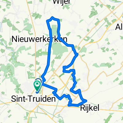
Watertoren Velm
A cycling route starting in Sint-Truiden, Flemish Region, Belgium.
Overview
About this route
Vanaf de uitkijk-watertoren naar Velm en via Landen rond Montenaken om weer terug te keren, de bedoeling is om het fietroutenetwerk te mijden en zoveel mogelijk rustige ruilverkavelingswegen te volgen.
- -:--
- Duration
- 33.3 km
- Distance
- 151 m
- Ascent
- 148 m
- Descent
- ---
- Avg. speed
- ---
- Max. altitude

Route quality
Waytypes & surfaces along the route
Waytypes
Quiet road
31.3 km
(94 %)
Road
2 km
(6 %)
Surfaces
Paved
26.6 km
(80 %)
Concrete
19 km
(57 %)
Asphalt
7.7 km
(23 %)
Undefined
6.7 km
(20 %)
Continue with Bikemap
Use, edit, or download this cycling route
You would like to ride Watertoren Velm or customize it for your own trip? Here is what you can do with this Bikemap route:
Free features
- Save this route as favorite or in collections
- Copy & plan your own version of this route
- Sync your route with Garmin or Wahoo
Premium features
Free trial for 3 days, or one-time payment. More about Bikemap Premium.
- Navigate this route on iOS & Android
- Export a GPX / KML file of this route
- Create your custom printout (try it for free)
- Download this route for offline navigation
Discover more Premium features.
Get Bikemap PremiumFrom our community
Other popular routes starting in Sint-Truiden
 Watertoren Velm
- Distance
- 33.3 km
- Ascent
- 151 m
- Descent
- 148 m
- Location
- Sint-Truiden, Flemish Region, Belgium
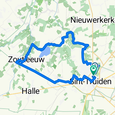
 EBu - Route Heers
- Distance
- 41.5 km
- Ascent
- 223 m
- Descent
- 226 m
- Location
- Sint-Truiden, Flemish Region, Belgium
 zomeravond fietstocht zuid
- Distance
- 24.6 km
- Ascent
- 102 m
- Descent
- 101 m
- Location
- Sint-Truiden, Flemish Region, Belgium
 St-Truiden 28.5 VG
- Distance
- 28.4 km
- Ascent
- 100 m
- Descent
- 101 m
- Location
- Sint-Truiden, Flemish Region, Belgium
 truden nach Hasselt über lummen
- Distance
- 49.8 km
- Ascent
- 121 m
- Descent
- 134 m
- Location
- Sint-Truiden, Flemish Region, Belgium
 BrustemThuisZammelenSchalkhoven
- Distance
- 26.5 km
- Ascent
- 229 m
- Descent
- 213 m
- Location
- Sint-Truiden, Flemish Region, Belgium
 St-Truiden-Het Vinne 25 VG
- Distance
- 24.6 km
- Ascent
- 53 m
- Descent
- 54 m
- Location
- Sint-Truiden, Flemish Region, Belgium
 Mettekoven-Gutschoven 30km
- Distance
- 30.2 km
- Ascent
- 165 m
- Descent
- 165 m
- Location
- Sint-Truiden, Flemish Region, Belgium
Open it in the app