

2-07 /Siepraw/
A cycling route starting in Czarnochowice, Lesser Poland Voivodeship, Poland.
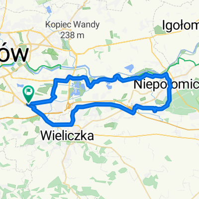
Overview
About this route
o tak o se trase zrobiłem
15:30 - ~18:15
miejsca postoju
Grabówki Pętla
Podstolice przystanek/sklep
Świątniki Górne sklep
ul. Gajowa w Sieprawiu
ul. Anieli Salawy przy ul. Brzeg
NB lody xd
- -:--
- Duration
- 43 km
- Distance
- 588 m
- Ascent
- 588 m
- Descent
- ---
- Avg. speed
- ---
- Max. altitude
Route quality
Waytypes & surfaces along the route
Waytypes
Road
23.6 km
(55 %)
Quiet road
16.1 km
(37 %)
Surfaces
Paved
39.1 km
(91 %)
Asphalt
37.8 km
(88 %)
Paving stones
1.3 km
(3 %)
Continue with Bikemap
Use, edit, or download this cycling route
You would like to ride 2-07 /Siepraw/ or customize it for your own trip? Here is what you can do with this Bikemap route:
Free features
- Save this route as favorite or in collections
- Copy & plan your own version of this route
- Sync your route with Garmin or Wahoo
Premium features
Free trial for 3 days, or one-time payment. More about Bikemap Premium.
- Navigate this route on iOS & Android
- Export a GPX / KML file of this route
- Create your custom printout (try it for free)
- Download this route for offline navigation
Discover more Premium features.
Get Bikemap PremiumFrom our community
Other popular routes starting in Czarnochowice
 Granica Czeska
- Distance
- 883.9 km
- Ascent
- 2,967 m
- Descent
- 3,002 m
- Location
- Czarnochowice, Lesser Poland Voivodeship, Poland
 Trzepak_Gliny Małe (prom)
- Distance
- 130.8 km
- Ascent
- 42 m
- Descent
- 97 m
- Location
- Czarnochowice, Lesser Poland Voivodeship, Poland
 Aleksandry 5, Краков до Поремба-Велька, Niedźwiedź
- Distance
- 75.5 km
- Ascent
- 1,655 m
- Descent
- 1,179 m
- Location
- Czarnochowice, Lesser Poland Voivodeship, Poland
 05.06.2010 - Pierwsza próba pobicia setki - niestety nieudana
- Distance
- 86.6 km
- Ascent
- 290 m
- Descent
- 290 m
- Location
- Czarnochowice, Lesser Poland Voivodeship, Poland
 Bieżanów - Staniątki - Puszcza Niepołomicka - Bieżanów I
- Distance
- 40 km
- Ascent
- 218 m
- Descent
- 218 m
- Location
- Czarnochowice, Lesser Poland Voivodeship, Poland
 Spokojna trasa w Kraków
- Distance
- 26.7 km
- Ascent
- 251 m
- Descent
- 252 m
- Location
- Czarnochowice, Lesser Poland Voivodeship, Poland
 Prokocim-Niepołomice-Prokocim
- Distance
- 43.5 km
- Ascent
- 111 m
- Descent
- 111 m
- Location
- Czarnochowice, Lesser Poland Voivodeship, Poland
 Krk-Mszana Dl
- Distance
- 106.6 km
- Ascent
- 840 m
- Descent
- 847 m
- Location
- Czarnochowice, Lesser Poland Voivodeship, Poland
Open it in the app