

Berndorf-Kall
A cycling route starting in Berndorf, Rhineland-Palatinate, Germany.
Overview
About this route
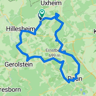
Berndorf-Alendorf-Blankenheimerdorf-Nettersheim
- -:--
- Duration
- 39.9 km
- Distance
- 337 m
- Ascent
- 461 m
- Descent
- ---
- Avg. speed
- ---
- Max. altitude

Route quality
Waytypes & surfaces along the route
Waytypes
Road
17.4 km
(44 %)
Track
11.8 km
(30 %)
Surfaces
Paved
22.1 km
(55 %)
Unpaved
7.7 km
(19 %)
Asphalt
20.3 km
(51 %)
Loose gravel
5 km
(12 %)
Continue with Bikemap
Use, edit, or download this cycling route
You would like to ride Berndorf-Kall or customize it for your own trip? Here is what you can do with this Bikemap route:
Free features
- Save this route as favorite or in collections
- Copy & plan your own version of this route
- Sync your route with Garmin or Wahoo
Premium features
Free trial for 3 days, or one-time payment. More about Bikemap Premium.
- Navigate this route on iOS & Android
- Export a GPX / KML file of this route
- Create your custom printout (try it for free)
- Download this route for offline navigation
Discover more Premium features.
Get Bikemap PremiumFrom our community
Other popular routes starting in Berndorf
 Kerpen – Adenau – Dankerath – Kerpen
- Distance
- 44.1 km
- Ascent
- 557 m
- Descent
- 557 m
- Location
- Berndorf, Rhineland-Palatinate, Germany
 Dreimühlenwasserfall Kerpen RWT
- Distance
- 11.1 km
- Ascent
- 170 m
- Descent
- 170 m
- Location
- Berndorf, Rhineland-Palatinate, Germany
 Boxtel-Wittlich teil Kerpen -Daun
- Distance
- 18.8 km
- Ascent
- 291 m
- Descent
- 299 m
- Location
- Berndorf, Rhineland-Palatinate, Germany
 Eifel-Ahr-Rhein-Mosel
- Distance
- 311.8 km
- Ascent
- 651 m
- Descent
- 672 m
- Location
- Berndorf, Rhineland-Palatinate, Germany
 Bahnhofstraße 18, Kerpen (Eifel) nach Kerpener Straße 9, Üxheim
- Distance
- 55.1 km
- Ascent
- 1,044 m
- Descent
- 1,062 m
- Location
- Berndorf, Rhineland-Palatinate, Germany
 Kerpen – Huppenbroich
- Distance
- 62.3 km
- Ascent
- 910 m
- Descent
- 837 m
- Location
- Berndorf, Rhineland-Palatinate, Germany
 Kerpen
- Distance
- 62.3 km
- Ascent
- 1,043 m
- Descent
- 1,023 m
- Location
- Berndorf, Rhineland-Palatinate, Germany
 Berndorf-Kall
- Distance
- 39.9 km
- Ascent
- 337 m
- Descent
- 461 m
- Location
- Berndorf, Rhineland-Palatinate, Germany
Open it in the app