domingo
- 73.4 km
- 545 m
- 506 m
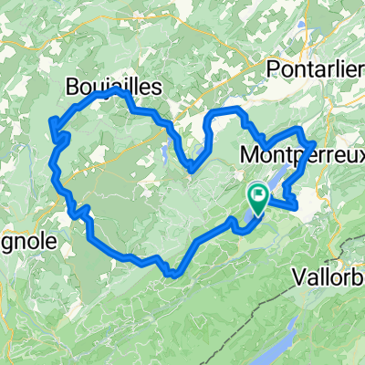
- Jougne, Bourgogne-Franche-Comté, France
A cycling route starting in Jougne, Bourgogne-Franche-Comté, France.
Overview
Route quality
Road
13.5 km
(29 %)
Quiet road
11.2 km
(24 %)
Paved
24.3 km
(52 %)
Unpaved
2.3 km
(5 %)
Asphalt
24.3 km
(52 %)
Gravel
0.9 km
(2 %)
Continue with Bikemap
You would like to ride Lac de Remory-Mouthe or customize it for your own trip? Here is what you can do with this Bikemap route:
Free trial for 3 days, or one-time payment. More about Bikemap Premium.
Discover more Premium features.
Get Bikemap PremiumFrom our community
Open it in the app