

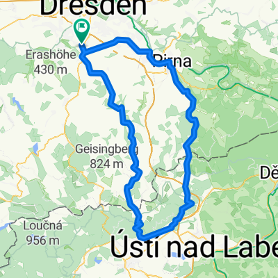
Die Autobahntour: 34 km Hügel im Dresdner Süden
A cycling route starting in Bannewitz, Saxony, Germany.
Overview
About this route
Short and crisp tour with a rolling profile through the villages. Low-traffic country roads in the southern part of Dresden. Crosses the motorway 6 times, sometimes under, sometimes over.
There are short sections of cobblestones, but it is good to ride on a road bike.
Especially beautiful in spring when the apple trees bloom.
- -:--
- Duration
- 33.9 km
- Distance
- 549 m
- Ascent
- 548 m
- Descent
- ---
- Avg. speed
- ---
- Max. altitude

Route quality
Waytypes & surfaces along the route
Waytypes
Quiet road
15.3 km
(45 %)
Road
11.2 km
(33 %)
Surfaces
Paved
32.5 km
(96 %)
Asphalt
32.5 km
(96 %)
Undefined
1.4 km
(4 %)
Continue with Bikemap
Use, edit, or download this cycling route
You would like to ride Die Autobahntour: 34 km Hügel im Dresdner Süden or customize it for your own trip? Here is what you can do with this Bikemap route:
Free features
- Save this route as favorite or in collections
- Copy & plan your own version of this route
- Sync your route with Garmin or Wahoo
Premium features
Free trial for 3 days, or one-time payment. More about Bikemap Premium.
- Navigate this route on iOS & Android
- Export a GPX / KML file of this route
- Create your custom printout (try it for free)
- Download this route for offline navigation
Discover more Premium features.
Get Bikemap PremiumFrom our community
Other popular routes starting in Bannewitz
 Radtour Elberadweg
- Distance
- 30.6 km
- Ascent
- 26 m
- Descent
- 32 m
- Location
- Bannewitz, Saxony, Germany
 Neues Leben, Bannewitz nach Neues Leben, Bannewitz über Schneekoppe
- Distance
- 111.6 km
- Ascent
- 1,921 m
- Descent
- 1,921 m
- Location
- Bannewitz, Saxony, Germany
 Die Autobahntour: 34 km Hügel im Dresdner Süden
- Distance
- 33.9 km
- Ascent
- 549 m
- Descent
- 548 m
- Location
- Bannewitz, Saxony, Germany
 RundumTour Bannewitz 2025
- Distance
- 31.6 km
- Ascent
- 447 m
- Descent
- 446 m
- Location
- Bannewitz, Saxony, Germany
 👌🏽😎AROUNDTRAILFREITAL😎👌🏽
- Distance
- 60.9 km
- Ascent
- 1,308 m
- Descent
- 1,302 m
- Location
- Bannewitz, Saxony, Germany
 2025 Tag 01 Von Dresden bis Elsterheide
- Distance
- 91.5 km
- Ascent
- 714 m
- Descent
- 762 m
- Location
- Bannewitz, Saxony, Germany
 kleine Sonntagsrunde
- Distance
- 23 km
- Ascent
- 337 m
- Descent
- 245 m
- Location
- Bannewitz, Saxony, Germany
 Vonovia-Tour
- Distance
- 28.8 km
- Ascent
- 121 m
- Descent
- 121 m
- Location
- Bannewitz, Saxony, Germany
Open it in the app