

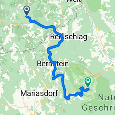
Buckelige Welt runde 2020
A cycling route starting in Bad Schönau, Lower Austria, Austria.
Overview
About this route
From Bad Schönau through the Buckelige Welt and back to Bad Schönau.
- -:--
- Duration
- 81.9 km
- Distance
- 1,339 m
- Ascent
- 1,338 m
- Descent
- ---
- Avg. speed
- ---
- Max. altitude

Route quality
Waytypes & surfaces along the route
Waytypes
Quiet road
32.8 km
(40 %)
Track
3.3 km
(4 %)
Surfaces
Paved
22.9 km
(28 %)
Unpaved
2.5 km
(3 %)
Asphalt
20.5 km
(25 %)
Concrete
2.5 km
(3 %)
Continue with Bikemap
Use, edit, or download this cycling route
You would like to ride Buckelige Welt runde 2020 or customize it for your own trip? Here is what you can do with this Bikemap route:
Free features
- Save this route as favorite or in collections
- Copy & plan your own version of this route
- Split it into stages to create a multi-day tour
- Sync your route with Garmin or Wahoo
Premium features
Free trial for 3 days, or one-time payment. More about Bikemap Premium.
- Navigate this route on iOS & Android
- Export a GPX / KML file of this route
- Create your custom printout (try it for free)
- Download this route for offline navigation
Discover more Premium features.
Get Bikemap PremiumFrom our community
Other popular routes starting in Bad Schönau
 Alpannonia kerékpáron 4
- Distance
- 29.4 km
- Ascent
- 636 m
- Descent
- 957 m
- Location
- Bad Schönau, Lower Austria, Austria
 Alpannonia Fischbach 4
- Distance
- 20.7 km
- Ascent
- 559 m
- Descent
- 784 m
- Location
- Bad Schönau, Lower Austria, Austria
 Vom Buckl zum Berg: 2-Tages-Tour
- Distance
- 132.6 km
- Ascent
- 1,405 m
- Descent
- 1,404 m
- Location
- Bad Schönau, Lower Austria, Austria
 Bad Schönau
- Distance
- 21.6 km
- Ascent
- 639 m
- Descent
- 646 m
- Location
- Bad Schönau, Lower Austria, Austria
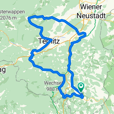
 Bucklige Welt Runde ab Bad Schönau
- Distance
- 73 km
- Ascent
- 1,807 m
- Descent
- 1,810 m
- Location
- Bad Schönau, Lower Austria, Austria
 Buckelige Welt runde 2020
- Distance
- 81.9 km
- Ascent
- 1,339 m
- Descent
- 1,338 m
- Location
- Bad Schönau, Lower Austria, Austria
 Tiefenbachstraße 12, Krumbach nach Tiefenbachstraße, Krumbach
- Distance
- 44.2 km
- Ascent
- 804 m
- Descent
- 799 m
- Location
- Bad Schönau, Lower Austria, Austria
 Bad Schönau - Ungerbach - Habich - Harmannsdorf - E 17 - Hutwisch - E 17 - Bad Schönau
- Distance
- 20.7 km
- Ascent
- 559 m
- Descent
- 559 m
- Location
- Bad Schönau, Lower Austria, Austria
Open it in the app