

V. Szelidi-tó kerékpártúra
A cycling route starting in Bonyhád, Tolna County, Hungary.
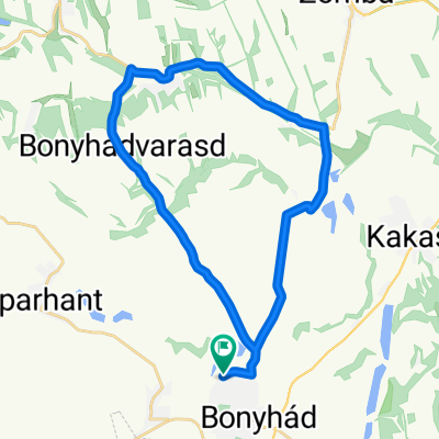
Overview
About this route
Since 2016, every year we have cycled with colleagues around the Szelidi Lake area. This was the fifth time.
- -:--
- Duration
- 152.4 km
- Distance
- 305 m
- Ascent
- 305 m
- Descent
- ---
- Avg. speed
- ---
- Max. altitude

Route quality
Waytypes & surfaces along the route
Waytypes
Cycleway
32 km
(21 %)
Quiet road
24.4 km
(16 %)
Surfaces
Paved
91.4 km
(60 %)
Unpaved
9.1 km
(6 %)
Asphalt
91.4 km
(60 %)
Gravel
9.1 km
(6 %)
Undefined
51.8 km
(34 %)
Continue with Bikemap
Use, edit, or download this cycling route
You would like to ride V. Szelidi-tó kerékpártúra or customize it for your own trip? Here is what you can do with this Bikemap route:
Free features
- Save this route as favorite or in collections
- Copy & plan your own version of this route
- Split it into stages to create a multi-day tour
- Sync your route with Garmin or Wahoo
Premium features
Free trial for 3 days, or one-time payment. More about Bikemap Premium.
- Navigate this route on iOS & Android
- Export a GPX / KML file of this route
- Create your custom printout (try it for free)
- Download this route for offline navigation
Discover more Premium features.
Get Bikemap PremiumFrom our community
Other popular routes starting in Bonyhád
 Tolna
Tolna- Distance
- 19.8 km
- Ascent
- 132 m
- Descent
- 195 m
- Location
- Bonyhád, Tolna County, Hungary
 Szálka-Grábóc
- Distance
- 19.8 km
- Ascent
- 405 m
- Descent
- 405 m
- Location
- Bonyhád, Tolna County, Hungary
 1. nap
- Distance
- 62 km
- Ascent
- 423 m
- Descent
- 424 m
- Location
- Bonyhád, Tolna County, Hungary
 Training route 7
- Distance
- 136.3 km
- Ascent
- 1,001 m
- Descent
- 1,001 m
- Location
- Bonyhád, Tolna County, Hungary
 Bonyhád-Kisdorog-Bonyhád
- Distance
- 27.3 km
- Ascent
- 243 m
- Descent
- 243 m
- Location
- Bonyhád, Tolna County, Hungary
 V. Szelidi-tó kerékpártúra
- Distance
- 152.4 km
- Ascent
- 305 m
- Descent
- 305 m
- Location
- Bonyhád, Tolna County, Hungary
 Októberi nyolcas
- Distance
- 31.7 km
- Ascent
- 318 m
- Descent
- 318 m
- Location
- Bonyhád, Tolna County, Hungary
 Bonyhád-Szecska halastó kerülés
- Distance
- 9.9 km
- Ascent
- 102 m
- Descent
- 94 m
- Location
- Bonyhád, Tolna County, Hungary
Open it in the app