

Cols de la Loire+Ardèche+Htes Alpes+Isère+Ain+Vaucluse
A cycling route starting in Venasque, Provence-Alpes-Côte d'Azur Region, France.
Overview
About this route
-
11 passes of the Loire: 10 Chauvot + 1 addendum 02-08
-
112 passes of Ardèche: 103 Chauvot + 6 addendums 02-08 + 3 addendums as of 01-09-09
Missing: col de la Baraque or col des Caïras (07) 780m CV(N)(O) in addendum modifying col 02-08
-
43 passes of the Hautes Alpes: 37 Chauvot + 3 addendums 02-08 + 3 addendums as of 01-09-09
-
3 passes of Isère: 3 Chauvot
-
2 passes of l'Ain: 1 Chauvot + 1 addendum as of 01-09-09
-
28 passes of Vaucluse: 22 Chauvot + 6 addendums 02-08
- -:--
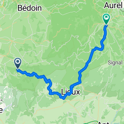
- Duration
- 62.5 km
- Distance
- 1,021 m
- Ascent
- 1,021 m
- Descent
- ---
- Avg. speed
- ---
- Max. altitude

Route quality
Waytypes & surfaces along the route
Waytypes
Road
40.6 km
(65 %)
Path
5.6 km
(9 %)
Surfaces
Paved
43.7 km
(70 %)
Unpaved
0.6 km
(1 %)
Asphalt
43.7 km
(70 %)
Gravel
0.6 km
(1 %)
Undefined
18.1 km
(29 %)
Route highlights
Points of interest along the route
Point of interest after 34.6 km
Le Collet (05) 762m CV
Point of interest after 51.5 km
Col des Astauds (84) 465m D242
Point of interest after 53.5 km
Col de Nesson (07) 340m CV "route panoramique"
Point of interest after 53.5 km
Le Col ou Col de Seyaret (07) 600m CV
Point of interest after 53.5 km
Col de Mayres ou Col de Roussillon (07) 595m D269/D287
Point of interest after 53.5 km
Col de Viaux (07) 199m D365/D265a
Point of interest after 53.5 km
Col du Fayet (07) 611m D109/D342
Point of interest after 53.5 km
Col de Rotisson (07) 425m D232/D479
Point of interest after 53.5 km
Col de Gihac (07) 519m D266
Point of interest after 53.5 km
Col Perrier (07) 744m CV
Point of interest after 53.5 km
Col de Fontfreyde (07) 835m CV
Point of interest after 53.5 km
Col de la Beaurie (42) 641m Voie Express
Point of interest after 53.5 km
Col du Gibet (07) 713m D27a
Point of interest after 53.5 km
Col du Buisson (07) 917m D236/D273
Point of interest after 53.5 km
Col du Banchet (42) 673m D503
Point of interest after 53.5 km
Col de Burdignes (42) 891m D22/D29
Point of interest after 53.5 km
Col de la Croix de Montvieux (42) 811m D62
Point of interest after 53.5 km
Le Tracol (42) 1083m D503/D74
Point of interest after 53.5 km
Le Tracol (07) 640m CV
Point of interest after 53.5 km
Col de Fontay ou Col de Fontaille (07) 619m D532
Point of interest after 53.5 km
Col de Gazareau (07) 571m D287
Point of interest after 53.5 km
Col des Ayes (07) 379m D479
Point of interest after 53.5 km
Le Tracol (07) 400m CV(E)
Point of interest after 53.5 km
Col de Méran (07) 545m D266
Point of interest after 59.7 km
Col de Brun (07) 1113m D276
Point of interest after 59.7 km
Col du Chapelet (07) 458m D344
Point of interest after 59.7 km
Col de la Croix de Cruas (07) 388m CV
Point of interest after 59.7 km
Col de St Alban ou col de Linte (07) 280m D422
Point of interest after 59.7 km
Le Tracol (07) 971m D236
Point of interest after 59.7 km
Col de Ceyssouan (07) 811m D241/D283
Point of interest after 59.7 km
Col des Croix de Gruas (07) 782m CV(N)
Point of interest after 59.7 km
Col des Meules (07) 525m CV
Point of interest after 59.7 km
Pertus du Soufre (07) 436m CV
Point of interest after 59.7 km
Col des Baraques (07) 1072m D105/D18
Point of interest after 59.7 km
Col du Trible (07) 540m D265
Point of interest after 59.7 km
Col du Sapet (07) 1087m D18
Point of interest after 59.7 km
Col des Buffes (07) 489m D2/CV
Point of interest after 59.8 km
Col des Tribles (07) 506m CV(S)
Point of interest after 59.8 km
Col des 4 Vios (07) 1149m D122/D211
Point of interest after 59.8 km
Col de Miraud (07) 986m CV(N)
Point of interest after 59.8 km
Col de la Fayolle (07) 887m D122/D218
Point of interest after 59.8 km
Goulet de Peyrille (07) 832m D218
Point of interest after 59.8 km
Coulet de la Soulière (07) 834m CV
Point of interest after 59.8 km
Col de Saraset (07) 825m D122/D256
Point of interest after 59.8 km
Col du Bénas (07) 795m D7/D224
Point of interest after 59.8 km
Col de l'Escrinet (07) 787m N104
Point of interest after 59.8 km
Col Croix St André ou Col des Croix de Creyseilles (07) 759m D360/D244
Point of interest after 59.8 km
Le Coulet (07) 729m CV(O)
Point of interest after 59.8 km
Col St Martin (07) 723m D213/CV
Point of interest after 59.8 km
Le Col (07) 710m CV
Point of interest after 59.8 km
Col de Fontenelle (07) 703m D213/D263
Point of interest after 59.8 km
Col de l'Arenier (07) 682m N104
Point of interest after 59.8 km
Col des Nonières (07) 670m D578/D21
Point of interest after 59.8 km
Col de Lavayas (07) 659m CV
Point of interest after 59.8 km
Le Coulet (07) 594m D244
Point of interest after 59.8 km
Col du Moulin à Vent (07) 592m D344/D2
Point of interest after 59.8 km
Le Coulet (07) 582m CV
Point of interest after 59.8 km
Col du Sablou (07) 506m CV(O)
Point of interest after 59.8 km
Col de Pichillon (42) 951m D498
Point of interest after 59.8 km
Col de la Croix de l'Homme Mort (42) 1163m D496
Point of interest after 59.8 km
Col des Limites (42) 1157m D496/D258
Point of interest after 59.8 km
Col de Palchad ou col de la Croix de Jounsiecq (42) 1140m D96/GR3
Point of interest after 59.8 km
Col de la Pelletière (42) 747m D20
Point of interest after 59.8 km
Col de Baracuchet (42) 1256m D113/D106
Point of interest after 59.8 km
Col de la Faye (07) 1019m D409/D409a
Point of interest after 59.8 km
Col de Crie ou Col de Batterie (07) 1029m D120/D21
Point of interest after 59.9 km
Col de Longe Serre (07) 438m CV
Point of interest after 59.9 km
Le Couletet (07) 605m CV
Point of interest after 59.9 km
Pas de Vendrias (07) 635m CV
Point of interest after 59.9 km
Col d'Aizac (07) 642m D254/D443
Point of interest after 59.9 km
Col de Font Rognon (07) 844m CV
Point of interest after 59.9 km
Le Col (07) 1110m D378
Point of interest after 59.9 km
Col de Moucheyre (07) 858m D254
Point of interest after 59.9 km
Col de Genestelle (07) 648m D318/D418
Point of interest after 59.9 km
Col de Valaurie (07) 649m CV(S)
Point of interest after 59.9 km
Col de Mézilhac (07) 1119m D204/D578
Point of interest after 59.9 km
Le Coulet (07) 650m CV
Point of interest after 59.9 km
Col de Conchis (07) 694m CV
Point of interest after 59.9 km
Col de Juvinas (07) 718m D343
Point of interest after 59.9 km
Col de Besses (07) 993m D237
Point of interest after 59.9 km
Col d'Auriolles (07) 495m N104/D356
Point of interest after 59.9 km
Collet de la Serre (07) 438m CV
Point of interest after 59.9 km
Col de Vals (07) 402m D257/D418
Point of interest after 59.9 km
Col de la Croix du Coulet (07) 551m D543
Point of interest after 59.9 km
Col de Montagnac (07) 558m CV
Point of interest after 60.4 km
Col de la Loube (07) 438m CV
Point of interest after 60.4 km
Col du Chap del Bosc (07) 1162m D4/D403
Point of interest after 60.4 km
Le Coulet (07) 900m D4
Point of interest after 60.4 km
Col d'Eyrolle (07) 548m D335
Point of interest after 60.4 km
Col de Pigère (07) 340m CV
Point of interest after 60.4 km
Col de la Serre (07) 371m D202
Point of interest after 60.4 km
Col de la Croix Millet (07) 776m D5
Point of interest after 60.4 km
Col des Farges (07) 520m D223
Point of interest after 60.4 km
Le Collet (07) 497m D51
Point of interest after 60.4 km
Col du Suchet (07) 483m D24/CV
Point of interest after 60.4 km
Col de la Croix de Rocles (07) 476m D24/CV
Point of interest after 60.4 km
Col de la Fare (07) 336m D262
Point of interest after 60.4 km
Pas à Brès (07) 459m D207/D250
Point of interest after 60.4 km
Le Coulet (07) 490m CV (S)
Point of interest after 60.4 km
Col du Grand Châtaignier (07) 315m D351/D130
Continue with Bikemap
Use, edit, or download this cycling route
You would like to ride Cols de la Loire+Ardèche+Htes Alpes+Isère+Ain+Vaucluse or customize it for your own trip? Here is what you can do with this Bikemap route:
Free features
- Save this route as favorite or in collections
- Copy & plan your own version of this route
- Sync your route with Garmin or Wahoo
Premium features
Free trial for 3 days, or one-time payment. More about Bikemap Premium.
- Navigate this route on iOS & Android
- Export a GPX / KML file of this route
- Create your custom printout (try it for free)
- Download this route for offline navigation
Discover more Premium features.
Get Bikemap PremiumFrom our community
Other popular routes starting in Venasque
 parijs nice 2013 5ième etappe
- Distance
- 144.7 km
- Ascent
- 2,814 m
- Descent
- 1,344 m
- Location
- Venasque, Provence-Alpes-Côte d'Azur Region, France
 Venasque-SaintSaturninlesApt-StHubert-Venasque
- Distance
- 79.2 km
- Ascent
- 1,147 m
- Descent
- 1,149 m
- Location
- Venasque, Provence-Alpes-Côte d'Azur Region, France
 VENASQUE - MONT VENTOUX
- Distance
- 34.6 km
- Ascent
- 1,761 m
- Descent
- 158 m
- Location
- Venasque, Provence-Alpes-Côte d'Azur Region, France
 1. Etappe Provence zum Genfer See
- Distance
- 96 km
- Ascent
- 1,023 m
- Descent
- 1,022 m
- Location
- Venasque, Provence-Alpes-Côte d'Azur Region, France
 BM-Gs-2015-provence-tag-27-s-1-20151027_102959-m1
- Distance
- 54.4 km
- Ascent
- 996 m
- Descent
- 1,000 m
- Location
- Venasque, Provence-Alpes-Côte d'Azur Region, France
 venasque sault hk
- Distance
- 46.9 km
- Ascent
- 1,466 m
- Descent
- 950 m
- Location
- Venasque, Provence-Alpes-Côte d'Azur Region, France
 Venasque - Sète et retour
- Distance
- 296.7 km
- Ascent
- 449 m
- Descent
- 449 m
- Location
- Venasque, Provence-Alpes-Côte d'Azur Region, France
 2. Etappe Provence - zum Genfer See
- Distance
- 95.2 km
- Ascent
- 1,996 m
- Descent
- 1,989 m
- Location
- Venasque, Provence-Alpes-Côte d'Azur Region, France
Open it in the app