

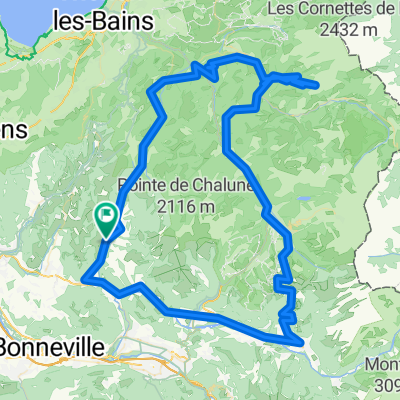
Haute Savoie: St-Jeoire - Onion - Cols de l'Avernas - de Ludran - des Moises - de Cou - de Terramont - de Jambaz
A cycling route starting in Saint-Jeoire, Auvergne-Rhône-Alpes, France.
Overview
About this route
St-Jeoire - Onion - Cols de l'avernas - de Ludran - des Moises - de Cou - de Terramont - de Jambaz - St-Jeoire
105 km selon compteur
- -:--
- Duration
- 103.9 km
- Distance
- 2,250 m
- Ascent
- 2,253 m
- Descent
- ---
- Avg. speed
- ---
- Max. altitude

Route quality
Waytypes & surfaces along the route
Waytypes
Road
60.5 km
(58 %)
Busy road
31.3 km
(30 %)
Surfaces
Paved
61.1 km
(59 %)
Unpaved
0.1 km
(<1 %)
Asphalt
61.1 km
(59 %)
Gravel
0.1 km
(<1 %)
Undefined
42.7 km
(41 %)
Continue with Bikemap
Use, edit, or download this cycling route
You would like to ride Haute Savoie: St-Jeoire - Onion - Cols de l'Avernas - de Ludran - des Moises - de Cou - de Terramont - de Jambaz or customize it for your own trip? Here is what you can do with this Bikemap route:
Free features
- Save this route as favorite or in collections
- Copy & plan your own version of this route
- Split it into stages to create a multi-day tour
- Sync your route with Garmin or Wahoo
Premium features
Free trial for 3 days, or one-time payment. More about Bikemap Premium.
- Navigate this route on iOS & Android
- Export a GPX / KML file of this route
- Create your custom printout (try it for free)
- Download this route for offline navigation
Discover more Premium features.
Get Bikemap PremiumFrom our community
Other popular routes starting in Saint-Jeoire
 Onnion, Samoens, Joux plane, Corbier, Ubine, Forclaz, Jambaz, Onnion
- Distance
- 145.4 km
- Ascent
- 3,254 m
- Descent
- 3,254 m
- Location
- Saint-Jeoire, Auvergne-Rhône-Alpes, France
 2013 09 08 COG St Jeoire- Areches (via Taninges)
- Distance
- 115.9 km
- Ascent
- 2,695 m
- Descent
- 2,250 m
- Location
- Saint-Jeoire, Auvergne-Rhône-Alpes, France
 Onnion Morzine Onnion
- Distance
- 85.5 km
- Ascent
- 1,179 m
- Descent
- 1,181 m
- Location
- Saint-Jeoire, Auvergne-Rhône-Alpes, France
 Haute Savoie: Col Ramaz - retour via Col de Feu
- Distance
- 98.3 km
- Ascent
- 2,110 m
- Descent
- 2,110 m
- Location
- Saint-Jeoire, Auvergne-Rhône-Alpes, France
 Cevennen Alpen 1995 Etappe 12
- Distance
- 47.4 km
- Ascent
- 631 m
- Descent
- 869 m
- Location
- Saint-Jeoire, Auvergne-Rhône-Alpes, France
 onnion joux plane Sixt fer Cheval, Onnio
- Distance
- 94.5 km
- Ascent
- 1,491 m
- Descent
- 1,485 m
- Location
- Saint-Jeoire, Auvergne-Rhône-Alpes, France
 Sortie 9
- Distance
- 87.8 km
- Ascent
- 936 m
- Descent
- 936 m
- Location
- Saint-Jeoire, Auvergne-Rhône-Alpes, France
 Haute Savoie: St-Jeoire - Onion - Cols de l'Avernas - de Ludran - des Moises - de Cou - de Terramont - de Jambaz
- Distance
- 103.9 km
- Ascent
- 2,250 m
- Descent
- 2,253 m
- Location
- Saint-Jeoire, Auvergne-Rhône-Alpes, France
Open it in the app