

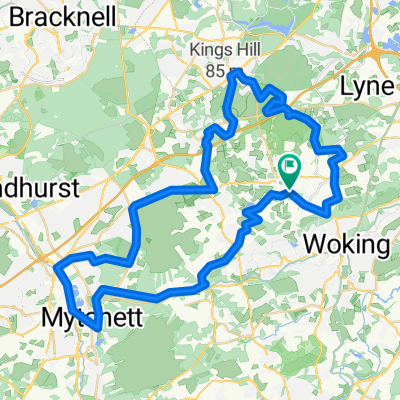
Test route V4, pennypot, sheets hill, tunnel hill deepcut
A cycling route starting in Chobham, England, United Kingdom.
Overview
About this route
- -:--
- Duration
- 33.7 km
- Distance
- 178 m
- Ascent
- 180 m
- Descent
- ---
- Avg. speed
- ---
- Max. altitude

Route highlights
Points of interest along the route
Point of interest after 14.1 km
Coffee Stop
Continue with Bikemap
Use, edit, or download this cycling route
You would like to ride Test route V4, pennypot, sheets hill, tunnel hill deepcut or customize it for your own trip? Here is what you can do with this Bikemap route:
Free features
- Save this route as favorite or in collections
- Copy & plan your own version of this route
- Sync your route with Garmin or Wahoo
Premium features
Free trial for 3 days, or one-time payment. More about Bikemap Premium.
- Navigate this route on iOS & Android
- Export a GPX / KML file of this route
- Create your custom printout (try it for free)
- Download this route for offline navigation
Discover more Premium features.
Get Bikemap PremiumFrom our community
Other popular routes starting in Chobham
 Evans Woking Off Road Long
- Distance
- 53.1 km
- Ascent
- 195 m
- Descent
- 194 m
- Location
- Chobham, England, United Kingdom
 Frimley to Woking
- Distance
- 52.9 km
- Ascent
- 244 m
- Descent
- 244 m
- Location
- Chobham, England, United Kingdom
 Test route V4, pennypot, sheets hill, tunnel hill deepcut
- Distance
- 33.7 km
- Ascent
- 178 m
- Descent
- 180 m
- Location
- Chobham, England, United Kingdom
 Staple Hill Road, Longcross, Chertsey to Staple Hill Road, Longcross, Chertsey
- Distance
- 8.9 km
- Ascent
- 99 m
- Descent
- 86 m
- Location
- Chobham, England, United Kingdom
 Chobham off road
- Distance
- 38.3 km
- Ascent
- 167 m
- Descent
- 166 m
- Location
- Chobham, England, United Kingdom
 TCC Dave Peck Memorial - Ladies Race
- Distance
- 4.7 km
- Ascent
- 45 m
- Descent
- 45 m
- Location
- Chobham, England, United Kingdom
 Staple Hill Road, Longcross, Chertsey to Chobham CP, Chertsey
- Distance
- 1.7 km
- Ascent
- 18 m
- Descent
- 39 m
- Location
- Chobham, England, United Kingdom
 Tunnel Hill Variant 2
- Distance
- 37.3 km
- Ascent
- 258 m
- Descent
- 255 m
- Location
- Chobham, England, United Kingdom
Open it in the app