

Marienfeld / Papsthügel
A cycling route starting in Altstadt Nord, North Rhine-Westphalia, Germany.
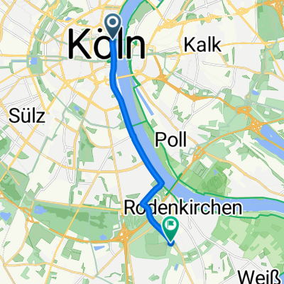
Overview
About this route
Marienfeld / Papsthügel Wir Radel auf dem Pilgerweg des Welt-jüngetages zum Marienfeld. Von dort Radeln Wir zurück nach Köln. Rucksackverpflegung. Evntl, Einkeher
- -:--
- Duration
- 56.6 km
- Distance
- 190 m
- Ascent
- 185 m
- Descent
- ---
- Avg. speed
- ---
- Max. altitude

Route quality
Waytypes & surfaces along the route
Waytypes
Path
20.7 km
(37 %)
Track
13.9 km
(25 %)
Surfaces
Paved
37.1 km
(66 %)
Unpaved
11.1 km
(20 %)
Asphalt
26.1 km
(46 %)
Gravel
7.7 km
(14 %)
Route highlights
Points of interest along the route

Photo after 9.3 km
Am Decksteiner Weiher

Photo after 24.3 km
Kerpen Brüggen

Photo after 28 km
Erft bei Kerpen Türnich

Photo after 34.5 km
Frechen, Marienfeld 2005/Weltjugendtag

Photo after 42.6 km
Blick auf Köln

Point of interest after 43.6 km
Altes Brauhaus Königsdorf: Aachener Straße 616, 50226 Frechen Telefon:02234 61581

Photo after 47.9 km
Randkanal
Continue with Bikemap
Use, edit, or download this cycling route
You would like to ride Marienfeld / Papsthügel or customize it for your own trip? Here is what you can do with this Bikemap route:
Free features
- Save this route as favorite or in collections
- Copy & plan your own version of this route
- Sync your route with Garmin or Wahoo
Premium features
Free trial for 3 days, or one-time payment. More about Bikemap Premium.
- Navigate this route on iOS & Android
- Export a GPX / KML file of this route
- Create your custom printout (try it for free)
- Download this route for offline navigation
Discover more Premium features.
Get Bikemap PremiumFrom our community
Other popular routes starting in Altstadt Nord
 Breite - A4 - Deutz - Zoobrücke - Hbf
- Distance
- 20.5 km
- Ascent
- 141 m
- Descent
- 145 m
- Location
- Altstadt Nord, North Rhine-Westphalia, Germany
 Forstbotanischer Garten, Köln
- Distance
- 7.5 km
- Ascent
- 41 m
- Descent
- 34 m
- Location
- Altstadt Nord, North Rhine-Westphalia, Germany
 Geopark Tannenbusch
- Distance
- 62.2 km
- Ascent
- 58 m
- Descent
- 62 m
- Location
- Altstadt Nord, North Rhine-Westphalia, Germany
 Im rechtsrheinischen Grüngürtel
- Distance
- 30.8 km
- Ascent
- 77 m
- Descent
- 67 m
- Location
- Altstadt Nord, North Rhine-Westphalia, Germany
 Köln - Koblenz
- Distance
- 95.1 km
- Ascent
- 123 m
- Descent
- 104 m
- Location
- Altstadt Nord, North Rhine-Westphalia, Germany
 CYCLING THE RHINE: Route R11A
- Distance
- 59.2 km
- Ascent
- 97 m
- Descent
- 108 m
- Location
- Altstadt Nord, North Rhine-Westphalia, Germany
 Königsdorf
- Distance
- 35.2 km
- Ascent
- 82 m
- Descent
- 71 m
- Location
- Altstadt Nord, North Rhine-Westphalia, Germany
 Phantasialand Brühl
- Distance
- 59.2 km
- Ascent
- 168 m
- Descent
- 171 m
- Location
- Altstadt Nord, North Rhine-Westphalia, Germany
Open it in the app