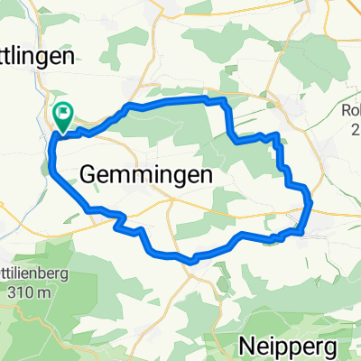
Kraichgau kreuzundschwer
A cycling route starting in Ittlingen, Baden-Württemberg, Germany.
Overview
About this route
Streckenverlauf:
Elsenz-Menzingen-Oberderdingen-Sternenfels-Häfnerhaslach-Zaberfeld-Sternenfels-Sulzfeld-Ochsenburg-Zaberfeld-Kleingartach-Eppingen-Adelshofen-Weiler-Hammerau-Birkenauerhof-Weiler-Waldangelloch-Elsenz
- -:--
- Duration
- 101 km
- Distance
- 972 m
- Ascent
- 972 m
- Descent
- ---
- Avg. speed
- ---
- Max. altitude
Route quality
Waytypes & surfaces along the route
Waytypes
Busy road
53.3 km
(53 %)
Road
33.8 km
(33 %)
Surfaces
Paved
82.4 km
(82 %)
Unpaved
2.9 km
(3 %)
Asphalt
81.9 km
(81 %)
Gravel
1.5 km
(1 %)
Continue with Bikemap
Use, edit, or download this cycling route
You would like to ride Kraichgau kreuzundschwer or customize it for your own trip? Here is what you can do with this Bikemap route:
Free features
- Save this route as favorite or in collections
- Copy & plan your own version of this route
- Split it into stages to create a multi-day tour
- Sync your route with Garmin or Wahoo
Premium features
Free trial for 3 days, or one-time payment. More about Bikemap Premium.
- Navigate this route on iOS & Android
- Export a GPX / KML file of this route
- Create your custom printout (try it for free)
- Download this route for offline navigation
Discover more Premium features.
Get Bikemap PremiumFrom our community
Other popular routes starting in Ittlingen
- Waldangelloch 01.11.20
- Distance
- 36.7 km
- Ascent
- 308 m
- Descent
- 308 m
- Location
- Ittlingen, Baden-Württemberg, Germany
- Kraichgau kreuzundschwer
- Distance
- 101 km
- Ascent
- 972 m
- Descent
- 972 m
- Location
- Ittlingen, Baden-Württemberg, Germany
- Landshausen, Neuenbürg, Odenheim
- Distance
- 34.6 km
- Ascent
- 380 m
- Descent
- 365 m
- Location
- Ittlingen, Baden-Württemberg, Germany
- Trainingsstrecke vom 25.02.2019
- Distance
- 25.5 km
- Ascent
- 254 m
- Descent
- 254 m
- Location
- Ittlingen, Baden-Württemberg, Germany
- Fünfmühlental
- Distance
- 130.3 km
- Ascent
- 1,286 m
- Descent
- 1,287 m
- Location
- Ittlingen, Baden-Württemberg, Germany
- Strecke Fünfmühlental
- Distance
- 132.9 km
- Ascent
- 1,194 m
- Descent
- 1,195 m
- Location
- Ittlingen, Baden-Württemberg, Germany
- Eichelberg über Weissach ( Porsche )-Eichelberg
- Distance
- 135.2 km
- Ascent
- 1,010 m
- Descent
- 1,012 m
- Location
- Ittlingen, Baden-Württemberg, Germany
- Ittlingen - Vaihingen a.d. Enz (Gündelbach)
- Distance
- 46.4 km
- Ascent
- 487 m
- Descent
- 426 m
- Location
- Ittlingen, Baden-Württemberg, Germany
Open it in the app