

UHU
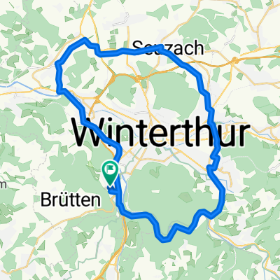
UHU Golfplatz-First-Wald-Töss
A cycling route starting in Töss (Kreis 4), Canton of Zurich, Switzerland.
Overview
About this route
- -:--
- Duration
- 23.8 km
- Distance
- 341 m
- Ascent
- 341 m
- Descent
- ---
- Avg. speed
- ---
- Max. altitude

Part of
UHU
4 stages
Route quality
Waytypes & surfaces along the route
Waytypes
Track
16.9 km
(71 %)
Quiet road
3.6 km
(15 %)
Surfaces
Paved
10.5 km
(44 %)
Unpaved
12.9 km
(54 %)
Gravel
10.3 km
(43 %)
Asphalt
8.1 km
(34 %)
Continue with Bikemap
Use, edit, or download this cycling route
You would like to ride UHU Golfplatz-First-Wald-Töss or customize it for your own trip? Here is what you can do with this Bikemap route:
Free features
- Save this route as favorite or in collections
- Copy & plan your own version of this route
- Sync your route with Garmin or Wahoo
Premium features
Free trial for 3 days, or one-time payment. More about Bikemap Premium.
- Navigate this route on iOS & Android
- Export a GPX / KML file of this route
- Create your custom printout (try it for free)
- Download this route for offline navigation
Discover more Premium features.
Get Bikemap PremiumFrom our community
Other popular routes starting in Töss (Kreis 4)
 Lange Ausfahrt von Winterthur nach Nürensdorf
- Distance
- 63.1 km
- Ascent
- 376 m
- Descent
- 303 m
- Location
- Töss (Kreis 4), Canton of Zurich, Switzerland
 Falch Rund um Winterthur
- Distance
- 31.9 km
- Ascent
- 192 m
- Descent
- 192 m
- Location
- Töss (Kreis 4), Canton of Zurich, Switzerland
 Arbeitsweg Jasmin hinweg
- Distance
- 10.6 km
- Ascent
- 75 m
- Descent
- 101 m
- Location
- Töss (Kreis 4), Canton of Zurich, Switzerland
 UHU Golfplatz-First-Wald-Töss
- Distance
- 23.8 km
- Ascent
- 341 m
- Descent
- 341 m
- Location
- Töss (Kreis 4), Canton of Zurich, Switzerland
 Töss runde
- Distance
- 19.8 km
- Ascent
- 125 m
- Descent
- 129 m
- Location
- Töss (Kreis 4), Canton of Zurich, Switzerland
 Winterthur - Schauenberg
- Distance
- 47.4 km
- Ascent
- 728 m
- Descent
- 728 m
- Location
- Töss (Kreis 4), Canton of Zurich, Switzerland
 001 Dättnau - Egnach, SA 25.07.20
- Distance
- 71.4 km
- Ascent
- 317 m
- Descent
- 378 m
- Location
- Töss (Kreis 4), Canton of Zurich, Switzerland
 Restful route in Winterthur
- Distance
- 33.3 km
- Ascent
- 434 m
- Descent
- 434 m
- Location
- Töss (Kreis 4), Canton of Zurich, Switzerland
Open it in the app