

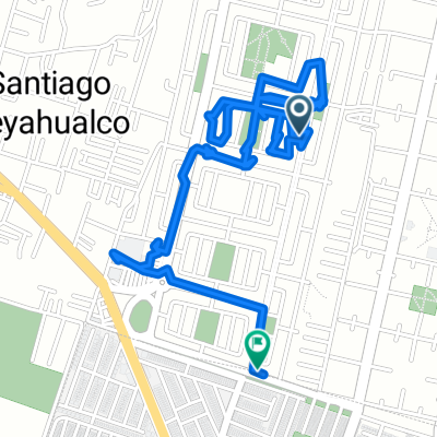
De Privada Circón a Privada Civilizacion Inca 2, Santiago Teyahualco
A cycling route starting in Santiago Teyahualco, State of Mexico, Mexico.
Overview
About this route
- 1 h 29 min
- Duration
- 17 km
- Distance
- 30 m
- Ascent
- 30 m
- Descent
- 11.4 km/h
- Avg. speed
- ---
- Max. altitude

Continue with Bikemap
Use, edit, or download this cycling route
You would like to ride De Privada Circón a Privada Civilizacion Inca 2, Santiago Teyahualco or customize it for your own trip? Here is what you can do with this Bikemap route:
Free features
- Save this route as favorite or in collections
- Copy & plan your own version of this route
- Sync your route with Garmin or Wahoo
Premium features
Free trial for 3 days, or one-time payment. More about Bikemap Premium.
- Navigate this route on iOS & Android
- Export a GPX / KML file of this route
- Create your custom printout (try it for free)
- Download this route for offline navigation
Discover more Premium features.
Get Bikemap PremiumFrom our community
Other popular routes starting in Santiago Teyahualco
 De Calle 5 21, Santiago Teyahualco a Calle 5 21, Santiago Teyahualco
- Distance
- 8 km
- Ascent
- 33 m
- Descent
- 30 m
- Location
- Santiago Teyahualco, State of Mexico, Mexico
 De Avenida Hacienda el Jazmín 26, Santiago Teyahualco a Avenida Felipe Carrillo Puerto 1065, Ecatepec de Morelos
- Distance
- 7.2 km
- Ascent
- 33 m
- Descent
- 30 m
- Location
- Santiago Teyahualco, State of Mexico, Mexico
 pantera
- Distance
- 6.2 km
- Ascent
- 146 m
- Descent
- 142 m
- Location
- Santiago Teyahualco, State of Mexico, Mexico
 tonto andy
- Distance
- 10.7 km
- Ascent
- 18 m
- Descent
- 15 m
- Location
- Santiago Teyahualco, State of Mexico, Mexico
 De Privada Circón a Privada Civilizacion Inca 2, Santiago Teyahualco
- Distance
- 17 km
- Ascent
- 30 m
- Descent
- 30 m
- Location
- Santiago Teyahualco, State of Mexico, Mexico
 Paseo rápido en Tultitlán de Mariano Escobedo
- Distance
- 8.9 km
- Ascent
- 71 m
- Descent
- 73 m
- Location
- Santiago Teyahualco, State of Mexico, Mexico
 De Circuito Hacienda Real de Tultepec Ote 1, Tultepec a Carretera Tultepec-Coacalco, Tultepec
- Distance
- 3.1 km
- Ascent
- 12 m
- Descent
- 5 m
- Location
- Santiago Teyahualco, State of Mexico, Mexico
 De Hermanos Serdán 262, Santiago Teyahualco a Mártires de Tlatelolco 22, Santiago Teyahualco
- Distance
- 73.2 km
- Ascent
- 73 m
- Descent
- 65 m
- Location
- Santiago Teyahualco, State of Mexico, Mexico
Open it in the app