

North Andover Start
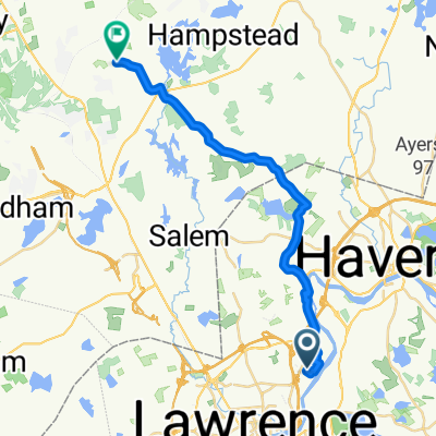
Plum Island
A cycling route starting in North Andover, Massachusetts, United States.
Overview
About this route
- 3 h 26 min
- Duration
- 68.1 km
- Distance
- 185 m
- Ascent
- 187 m
- Descent
- 19.9 km/h
- Avg. speed
- ---
- Max. altitude

Part of
North Andover Start
1 stage
Route quality
Waytypes & surfaces along the route
Waytypes
Quiet road
6.1 km
(9 %)
Road
2 km
(3 %)
Surfaces
Paved
48.3 km
(71 %)
Asphalt
48.3 km
(71 %)
Undefined
19.7 km
(29 %)
Continue with Bikemap
Use, edit, or download this cycling route
You would like to ride Plum Island or customize it for your own trip? Here is what you can do with this Bikemap route:
Free features
- Save this route as favorite or in collections
- Copy & plan your own version of this route
- Sync your route with Garmin or Wahoo
Premium features
Free trial for 3 days, or one-time payment. More about Bikemap Premium.
- Navigate this route on iOS & Android
- Export a GPX / KML file of this route
- Create your custom printout (try it for free)
- Download this route for offline navigation
Discover more Premium features.
Get Bikemap PremiumFrom our community
Other popular routes starting in North Andover
 Lake Cochichewick Circle
- Distance
- 11 km
- Ascent
- 113 m
- Descent
- 111 m
- Location
- North Andover, Massachusetts, United States
 By the Sea
- Distance
- 51.6 km
- Ascent
- 151 m
- Descent
- 158 m
- Location
- North Andover, Massachusetts, United States
 Plum Island
- Distance
- 68.1 km
- Ascent
- 185 m
- Descent
- 187 m
- Location
- North Andover, Massachusetts, United States
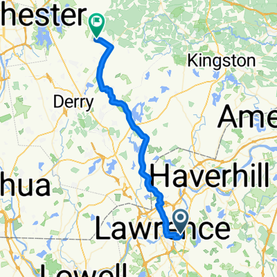
 to Hampstead
- Distance
- 23.1 km
- Ascent
- 305 m
- Descent
- 197 m
- Location
- North Andover, Massachusetts, United States
 Trip to work
- Distance
- 41.7 km
- Ascent
- 618 m
- Descent
- 498 m
- Location
- North Andover, Massachusetts, United States
 Gibson Court 30, North Andover to Main Street 2, Andover
- Distance
- 11.5 km
- Ascent
- 27 m
- Descent
- 22 m
- Location
- North Andover, Massachusetts, United States
 Walmart NH and Back
- Distance
- 34.2 km
- Ascent
- 176 m
- Descent
- 177 m
- Location
- North Andover, Massachusetts, United States
 Gibson Court 30, North Andover to Gibson Court 30, North Andover
- Distance
- 16.3 km
- Ascent
- 7 m
- Descent
- 13 m
- Location
- North Andover, Massachusetts, United States
Open it in the app