

Vuelta La Pita 01
A cycling route starting in Atenas, Alajuela Province, Costa Rica.
Overview
About this route
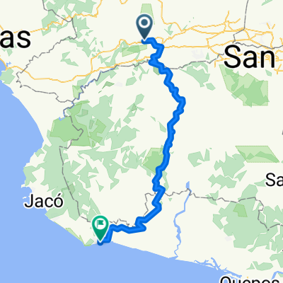
La Garita, Atenas, Escobal, La Pita, Barbacoas, Picagres, Turrucares, La Garita
- -:--
- Duration
- 78.3 km
- Distance
- 1,765 m
- Ascent
- 1,766 m
- Descent
- ---
- Avg. speed
- ---
- Max. altitude

Route quality
Waytypes & surfaces along the route
Waytypes
Road
25.8 km
(33 %)
Quiet road
18 km
(23 %)
Undefined
34.5 km
(44 %)
Surfaces
Paved
36 km
(46 %)
Unpaved
1.6 km
(2 %)
Asphalt
36 km
(46 %)
Unpaved (undefined)
1.6 km
(2 %)
Undefined
40.7 km
(52 %)
Continue with Bikemap
Use, edit, or download this cycling route
You would like to ride Vuelta La Pita 01 or customize it for your own trip? Here is what you can do with this Bikemap route:
Free features
- Save this route as favorite or in collections
- Copy & plan your own version of this route
- Sync your route with Garmin or Wahoo
Premium features
Free trial for 3 days, or one-time payment. More about Bikemap Premium.
- Navigate this route on iOS & Android
- Export a GPX / KML file of this route
- Create your custom printout (try it for free)
- Download this route for offline navigation
Discover more Premium features.
Get Bikemap PremiumFrom our community
Other popular routes starting in Atenas
 Calle Real, Atenas to Calle Esterillos Oeste, Parrita
- Distance
- 100 km
- Ascent
- 3,915 m
- Descent
- 4,715 m
- Location
- Atenas, Alajuela Province, Costa Rica
 Vuelta La Pita 01
- Distance
- 78.3 km
- Ascent
- 1,765 m
- Descent
- 1,766 m
- Location
- Atenas, Alajuela Province, Costa Rica
 Calle Los Mangos, Atenas a Calle Los Mangos, Atenas
- Distance
- 15.3 km
- Ascent
- 509 m
- Descent
- 508 m
- Location
- Atenas, Alajuela Province, Costa Rica
 De Calle Rodríguez, Santa Eulalia a Calle Rodríguez, Santa Eulalia
- Distance
- 14.4 km
- Ascent
- 302 m
- Descent
- 306 m
- Location
- Atenas, Alajuela Province, Costa Rica
 MTB hogar
- Distance
- 24.6 km
- Ascent
- 1,538 m
- Descent
- 1,549 m
- Location
- Atenas, Alajuela Province, Costa Rica
 Atenas to Puntarenas
- Distance
- 69.2 km
- Ascent
- 888 m
- Descent
- 1,440 m
- Location
- Atenas, Alajuela Province, Costa Rica
 De 707, Escobal a Autopista José María Castro Madriz, Cascajal
- Distance
- 30.8 km
- Ascent
- 60 m
- Descent
- 286 m
- Location
- Atenas, Alajuela Province, Costa Rica
 UTN - Guarco Cartago
- Distance
- 84.7 km
- Ascent
- 2,484 m
- Descent
- 1,507 m
- Location
- Atenas, Alajuela Province, Costa Rica
Open it in the app