

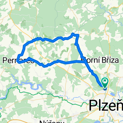
140 km Okolo Plzně
A cycling route starting in Třemošná, Plzeň Region, Czechia.
Overview
About this route
Option for refreshments along the way (refreshments with a garden): Blovice - Čabarda
- -:--
- Duration
- 140.8 km
- Distance
- 800 m
- Ascent
- 799 m
- Descent
- ---
- Avg. speed
- ---
- Max. altitude

Route quality
Waytypes & surfaces along the route
Waytypes
Road
53.5 km
(38 %)
Quiet road
7 km
(5 %)
Surfaces
Paved
32.4 km
(23 %)
Asphalt
32.4 km
(23 %)
Undefined
108.4 km
(77 %)
Continue with Bikemap
Use, edit, or download this cycling route
You would like to ride 140 km Okolo Plzně or customize it for your own trip? Here is what you can do with this Bikemap route:
Free features
- Save this route as favorite or in collections
- Copy & plan your own version of this route
- Split it into stages to create a multi-day tour
- Sync your route with Garmin or Wahoo
Premium features
Free trial for 3 days, or one-time payment. More about Bikemap Premium.
- Navigate this route on iOS & Android
- Export a GPX / KML file of this route
- Create your custom printout (try it for free)
- Download this route for offline navigation
Discover more Premium features.
Get Bikemap PremiumFrom our community
Other popular routes starting in Třemošná
 Koloběžky silnice 70 km Okolo Plzně
- Distance
- 69.2 km
- Ascent
- 801 m
- Descent
- 801 m
- Location
- Třemošná, Plzeň Region, Czechia
 Úněšov 60
- Distance
- 60.1 km
- Ascent
- 482 m
- Descent
- 482 m
- Location
- Třemošná, Plzeň Region, Czechia
 Středa 28.6
- Distance
- 23 km
- Ascent
- 204 m
- Descent
- 179 m
- Location
- Třemošná, Plzeň Region, Czechia
 180 km Památky a gastronomie Blatná, Žinkovy, pivovar Letiny "silniční Borec"
- Distance
- 180.8 km
- Ascent
- 1,780 m
- Descent
- 1,780 m
- Location
- Třemošná, Plzeň Region, Czechia
 2013-04-29-ke Chlumu
- Distance
- 26.4 km
- Ascent
- 264 m
- Descent
- 261 m
- Location
- Třemošná, Plzeň Region, Czechia
 Sidlovak – Chotikov – Malesicka skala – Radcice –Sylvan – Sidlovak
- Distance
- 14.6 km
- Ascent
- 203 m
- Descent
- 207 m
- Location
- Třemošná, Plzeň Region, Czechia
 Červená turistická značka 0205
- Distance
- 30.7 km
- Ascent
- 450 m
- Descent
- 486 m
- Location
- Třemošná, Plzeň Region, Czechia
 100 km Údolím Berounky "MTB Sporťák"
- Distance
- 101.2 km
- Ascent
- 2,004 m
- Descent
- 2,004 m
- Location
- Třemošná, Plzeň Region, Czechia
Open it in the app