

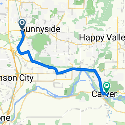
partial Gladstone Loop
A cycling route starting in Clackamas, Oregon, United States.
Overview
About this route
- 35 min
- Duration
- 10.7 km
- Distance
- 57 m
- Ascent
- 72 m
- Descent
- 18.5 km/h
- Avg. speed
- ---
- Max. altitude

Route quality
Waytypes & surfaces along the route
Waytypes
Road
4.6 km
(43 %)
Path
2.1 km
(20 %)
Surfaces
Paved
2.5 km
(23 %)
Paved (undefined)
1.7 km
(16 %)
Asphalt
0.7 km
(7 %)
Undefined
8.2 km
(77 %)
Continue with Bikemap
Use, edit, or download this cycling route
You would like to ride partial Gladstone Loop or customize it for your own trip? Here is what you can do with this Bikemap route:
Free features
- Save this route as favorite or in collections
- Copy & plan your own version of this route
- Sync your route with Garmin or Wahoo
Premium features
Free trial for 3 days, or one-time payment. More about Bikemap Premium.
- Navigate this route on iOS & Android
- Export a GPX / KML file of this route
- Create your custom printout (try it for free)
- Download this route for offline navigation
Discover more Premium features.
Get Bikemap PremiumFrom our community
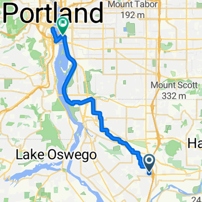
Other popular routes starting in Clackamas
 9800 SE Stevens Rd, Clackamas to 15023 SE Pebble Beach Dr, Happy Valley
- Distance
- 7.1 km
- Ascent
- 153 m
- Descent
- 83 m
- Location
- Clackamas, Oregon, United States
 partial Gladstone Loop
- Distance
- 10.7 km
- Ascent
- 57 m
- Descent
- 72 m
- Location
- Clackamas, Oregon, United States
 I-205 Multi Use Path, Clackamas to Southeast Foss Street 16359, Damascus
- Distance
- 9.6 km
- Ascent
- 45 m
- Descent
- 52 m
- Location
- Clackamas, Oregon, United States
 Route to SE Caruthers St, Portland
- Distance
- 22 km
- Ascent
- 104 m
- Descent
- 145 m
- Location
- Clackamas, Oregon, United States
 Southeast 90th Avenue 15167, Clackamas to Washington Street 1114, Oregon City
- Distance
- 8.3 km
- Ascent
- 55 m
- Descent
- 72 m
- Location
- Clackamas, Oregon, United States
 Happy Valley Stairs 7
- Distance
- 11.2 km
- Ascent
- 389 m
- Descent
- 390 m
- Location
- Clackamas, Oregon, United States
 Birthday route
- Distance
- 32 km
- Ascent
- 205 m
- Descent
- 205 m
- Location
- Clackamas, Oregon, United States
 OC to Mt Talbert Park
- Distance
- 15.7 km
- Ascent
- 230 m
- Descent
- 208 m
- Location
- Clackamas, Oregon, United States
Open it in the app